By Kate Burch
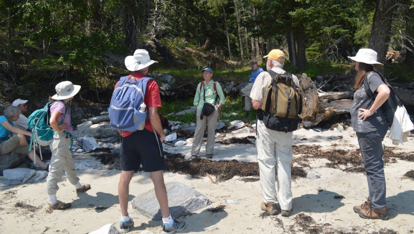
Photo via Maine Midden Minders
Middens record the history of Maine’s first inhabitants, providing evidence of ancient lives and environments from 5,000 years ago until the time of European settlement. Largely composed of shells and animal remains, along with seeds, stone tools, and pieces of pottery, middens have often been referred to as “ancient trash heaps”, but archaeologists now recognize that they represent more than just waste disposal. Maine’s middens are some of our most at-risk heritage sites due to climate change, as sea level rise hastens the rate of coastal erosion.
At the University of Maine, the Midden Minders project is using volunteer citizen scientists to document these important sites and monitor their condition and erosion. Dr. Alice Kelley and Dr. Bonnie Newsom, who lead the project, shared more information with Greater Portland Landmarks about Midden Minders and the risks facing middens.
GPL: How many known sites remain undocumented, and what would it take to document them?

Shell midden with meter measuring stick for scale (Photo via Maine Midden Minders)
Kelley and Newsom: According to Dr. Arthur Spiess, Maine State Archaeologist, there are approx. 2000 documented shell midden sites on Maine’s islands and mainland coastline. These sites have been identified, but are at varying levels of analysis and reporting. We don’t know how many sites remain undocumented, but do know that new sites are discovered every year, while other sites are lost to erosion or development or damaged by looting. A coast-wide survey of the Maine coasts and islands would be required to locate, examine and document all of Maine’s known shell middens. This would be a challenging (and expensive) task.
Currently, members of the public or conservation organizations are welcome to report the locations of shell middens to the Midden Minders (middenminders@maine.edu). We will see that the information is forwarded to the appropriate federal, state, or tribal agency for documentation.
GPL: What types of sites are most at risk, and what can be done to preserve them?
Kelley and Newsom: Sites that are located directly on the shoreline, either on a beach or a bluff, are the most at risk. Climate change-related sea level rise, increasing storm intensity and frequency, and more periods of winter freeze-thaw activity are increasing shoreline erosion. As bluffs and beaches along the coast erode, shell middens collapse and are lost to the sea.
Preserving shell middens is not possible, but the cultural and environmental information they contain can be preserved. This is what the Midden Minders and archaeology field schools in collaborations with conservation and professional and tribal organizations are working to do.
The Midden Minders project seeks to monitor and document the erosion of shell middens using a variety of measurement techniques and photography (see maine.edu/middenminders). Conservation and tribal organizations are working to collaborate with the Midden Minders to document change and preserve information and protect shell middens from looting, erosion, and development.
GPL: What information and cultural heritage is at risk of being lost if we lose these sites?
Kelley and Newsom: Thousands of years of indigenous history and lifeways are archived in shell middens. This important part of Maine’s history is being lost to the sea as these sites disappear. In the past, the cultural history of indigenous people living as coastal hunters, fishers and gatherers has been largely marginalized and discounted, while colonial and historic structures are awarded attention and preservation funding. The middens’ record of thousands of years of sustainable use of the coast and adaptation to change may be relevant to today’s climate change issues. The knowledge contained in shell middens also provides an opportunity for contemporary tribal communities to reconnect with a disrupted past and strengthen tribal communities.
Additionally, shell middens contain a record of the past environments when they were formed. The faunal and floral remains in the middens are a record of conditions at that time. Shell middens are an archive of extinct species, such as great auk and sea mink, that are not preserved elsewhere. This material is one of the very few archives of coastal conditions thousands of years ago.
GPL: What is the history of efforts to preserve midden sites in Maine?

A 19th century investor in a project to turn middens into chicken feed surveys a midden in Maine.
Kelley and Newsom: In the past, shell middens were viewed as a resource to use or a source of artifacts for amusement and display. Considered trash heaps, the shells were mined to provide lime or ground up for chicken feed. Early archaeologists viewed the middens as a source of interesting animal bones and artifacts. Currently, archaeologists value the middens as an archive of past lifeways and environments and local tribal people value them as part of their ancestral heritage. Excavations carefully record details about the site, landscape, artifacts, materials, and stratigraphy, in such a way that the site can be reconstructed digitally and archaeological and environmental information is preserved. House floors, activity areas, and firepits can be recognized through careful excavation. Additionally, archaeologists at modern excavations work closely with descendant communities on data recovery, preservation and interpretation as a way to connect past and present peoples.
However, archaeological excavations are expensive in time and funding. As a result, only a few middens are carefully excavated each year. The Midden Minders program seeks to support the preservation of midden information by monitoring and documenting shell midden erosion along Maine’s coast. In this effort, volunteer citizen scientists use simple tools to measure erosion and photography to document change and artifacts. The information gathered will be used by cultural resource managers and researchers to make informed decisions about excavations and help understand the impact of climate change on cultural heritage.
To learn more and volunteer, visit the Maine Midden Minders website!