Maine Midden Minders

By Kate Burch

Photo via Maine Midden Minders

Photo via Maine Midden Minders

Middens record the history of Maine’s first inhabitants, providing evidence of ancient lives and environments from 5,000 years ago until the time of European settlement.  Largely composed of shells and animal remains, along with seeds, stone tools, and pieces of pottery, middens have often been referred to as “ancient trash heaps”, but archaeologists now recognize that they represent more than just waste disposal. Maine’s middens are some of our most at-risk heritage sites due to climate change, as sea level rise hastens the rate of coastal erosion.

At the University of Maine, the Midden Minders project is using volunteer citizen scientists to document these important sites and monitor their condition and erosion. Dr. Alice Kelley and Dr. Bonnie Newsom, who lead the project, shared more information with Greater Portland Landmarks about Midden Minders and the risks facing middens.

GPL: How many known sites remain undocumented, and what would it take to document them?

Shell midden with meter measuring stick for scale (Photo via Maine Midden Minders)

Shell midden with meter measuring stick for scale (Photo via Maine Midden Minders)

Kelley and Newsom: According to Dr. Arthur Spiess, Maine State Archaeologist, there are approx. 2000 documented shell midden sites on Maine’s islands and mainland coastline.  These sites have been identified, but are at varying levels of analysis and reporting.  We don’t know how many sites remain undocumented, but do know that new sites are discovered every year, while other sites are lost to erosion or development or damaged by looting.  A coast-wide survey of the Maine coasts and islands would be required to locate, examine and document all of Maine’s known shell middens.  This would be a challenging (and expensive) task.

Currently, members of the public or conservation organizations are welcome to report the locations of shell middens to the Midden Minders (middenminders@maine.edu).  We will see that the information is forwarded to the appropriate federal, state, or tribal agency for documentation.

GPL: What types of sites are most at risk, and what can be done to preserve them?

Kelley and Newsom:  Sites that are located directly on the shoreline, either on a beach or a bluff, are the most at risk.  Climate change-related sea level rise, increasing storm intensity and frequency, and more periods of winter freeze-thaw activity are increasing shoreline erosion. As bluffs and beaches along the coast erode, shell middens collapse and are lost to the sea.

Preserving shell middens is not possible, but the cultural and environmental information they contain can be preserved.  This is what the Midden Minders and archaeology field schools in collaborations with conservation and professional and tribal organizations are working to do.

The Midden Minders project seeks to monitor and document the erosion of shell middens using a variety of measurement techniques and photography (see maine.edu/middenminders).  Conservation and tribal organizations are working to collaborate with the Midden Minders to document change and preserve information and protect shell middens from looting, erosion, and development.

GPL: What information and cultural heritage is at risk of being lost if we lose these sites?

Kelley and Newsom:  Thousands of years of indigenous history and lifeways are archived in shell middens. This important part of Maine’s history is being lost to the sea as these sites disappear.  In the past, the cultural history of indigenous people living as coastal hunters, fishers and gatherers has been largely marginalized and discounted, while colonial and historic structures are awarded attention and preservation funding. The middens’ record of thousands of years of sustainable use of the coast and adaptation to change may be relevant to today’s climate change issues.  The knowledge contained in shell middens also provides an opportunity for contemporary tribal communities to reconnect with a disrupted past and strengthen tribal communities.

Additionally, shell middens contain a record of the past environments when they were formed.  The faunal and floral remains in the middens are a record of conditions at that time.  Shell middens are an archive of extinct species, such as great auk and sea mink, that are not preserved elsewhere.  This material is one of the very few archives of coastal conditions thousands of years ago.

GPL: What is the history of efforts to preserve midden sites in Maine?

A 19th century investor in a project to turn middens into chicken feed surveys a midden in Maine.

A 19th century investor in a project to turn middens into chicken feed surveys a midden in Maine.

Kelley and Newsom:  In the past, shell middens were viewed as a resource to use or a source of artifacts for amusement and display.  Considered trash heaps, the shells were mined to provide lime or ground up for chicken feed.  Early archaeologists viewed the middens as a source of interesting animal bones and artifacts.  Currently, archaeologists value the middens as an archive of past lifeways and environments and local tribal people value them as part of their ancestral heritage.  Excavations carefully record details about the site, landscape, artifacts, materials, and stratigraphy, in such a way that the site can be reconstructed digitally and archaeological and environmental information is preserved.  House floors, activity areas, and firepits can be recognized through careful excavation. Additionally, archaeologists at modern excavations work closely with descendant communities on data recovery, preservation and interpretation as a way to connect past and present peoples.

However, archaeological excavations are expensive in time and funding.  As a result, only a few middens are carefully excavated each year.  The Midden Minders program seeks to support the preservation of midden information by monitoring and documenting shell midden erosion along Maine’s coast.  In this effort, volunteer citizen scientists use simple tools to measure erosion and photography to document change and artifacts.  The information gathered will be used by cultural resource managers and researchers to make informed decisions about excavations and help understand the impact of climate change on cultural heritage.

To learn more and volunteer, visit the Maine Midden Minders website!

The Summer Cottages of John Calvin Stevens

By Kate Burch

John Calvin Stevens

John Calvin Stevens

John Calvin Stevens (1855-1940) is one of our hometown heroes – he designed more than 1,000 buildings in Maine, many of them in greater Portland, and his grandson John Calvin Stevens II was one of the founders of Greater Portland Landmarks. JCS, as we call him, could fill several blog posts, but for our August Architect of the Month, we’re focusing on his iconic summer cottages in the Shingle style.

Stevens was born in Boston in 1855 and moved to Portland, Maine with his family at the age of 2. He wanted to study architecture at the Massachusetts Institute of Technology, but couldn’t afford it, so he apprenticed in the Portland office of architect Francis Fassett instead. Stevens was a fast learner and a skilled draftsman, and in seven years rose from office boy to partner in the firm, which was renamed Fassett and Stevens. In 1884, he established his own office in Portland, with Fassett’s blessing.

The John Calvin Stevens House (1884) on Bowdoin Street

The John Calvin Stevens House (1884) on Bowdoin Street

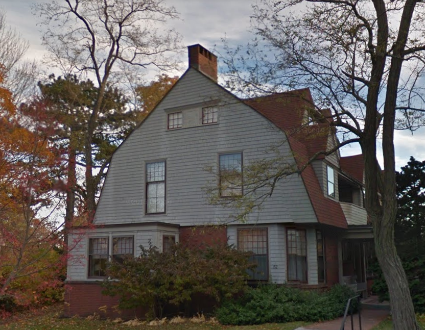
Shingle Style was coming to prominence around 1880, when JCS was working in Fassett’s short-lived Boston office. The firm worked in the same office building as William Randolph Emerson, who by then was working in his signature Shingle Style, and his work was very influential to JCS. In 1884, upon establishing his own office in Portland, Stevens built his own home at 52 Bowdoin Street in the Shingle Style. One of Portland’s earliest examples of the style, JCS often used it for promotion. The house received international notice after its construction.

Shingle-style architecture developed in the late 19th century as a departure from the lavish decoration of other Victorian styles. Inspired by the simplicity of materials and form of early New England architecture, these houses used natural colors and unembellished shingles on both walls and roof to form a uniform surface. The graying of the cedar shingles as they aged lent a sense of history and connection to New England’s past, and some architects even pre-aged the shakes before installation to achieve a weathered look. Shingle style houses borrow elements from other popular styles of the time, such as the wide porches of Queen Anne homes, the Palladian windows of the Colonial Revival, and the rusticated masonry of the Romanesque Revival.

Kragsyde (1883-1885, demolished 1929), designed by the Boston firm Peabody & Stearns

Kragsyde (1883-1885, demolished 1929), designed by the Boston firm Peabody & Stearns

Though inspired by the rusticity of the local vernacular, these early Shingle Style buildings were far from simple. Shingle Style was popularized by large-scale commissions for seaside summer homes for the wealthy in places like Manchester-By-The-Sea, Massachusetts and Newport, Rhode Island. The style never really spread too far from the New England coast – it’s uncommon in vernacular housing. In Maine, it became the style of choice for grand summer homes and resorts that in the late 19th century were increasingly cropping up on Maine’s coast and islands.

C.A. Brown Cottage (1886-87) in Delano Park, Cape Elizabeth, designed by JCS.

C.A. Brown Cottage (1886-87) in Delano Park, Cape Elizabeth, designed by JCS.

Stevens’ Shingle style coastal homes were recognized not just for their style but for their relationship with the landscape. Large piazzas and picture windows, with interior space planned to take advantage of the scenery, made these buildings feel harmonious with their surroundings. It’s perhaps not surprising that Stevens was so good at designing buildings that felt connected to their landscape – he was also an accomplished landscape painter and a member of the Portland-based art group that called themselves the “Brushuns”, who went on weekend sketching expeditions along the Maine coast (Winslow Homer and Charles F. Kimball were also members). Of his design work, his grandson John Calvin Stevens II wrote “The ‘seeing of the site’ is to him ceremonial. Every contour, tree, rock, stream, spring is recorded on the drawing board in his brain. Orientation, vistas and outlooks, prevalent windows and neighborhood developments are studied.”

(If you’re interested in learning more about JCS’s paintings, our book The Paintings of John Calvin Stevens is currently on sale in our shop!)

“Delano Park, Cape Elizabeth” (1904) by JCS

“Delano Park, Cape Elizabeth” (1904) by JCS

JCS designed dozens of seaside summer homes, from grand estates to more modest cottages, all along the coast of Maine and on the islands. Here are just a few examples of Stevens’ summery projects:

The Homers on Prouts Neck

Prouts Neck in Scarborough was one of many Maine coastal areas that became a fashionable summer resort in the late 19th century. Painter Winslow Homer vacationed there with his brothers Arthur and Charles. All three brothers commissioned JCS to design homes for them on Prouts Neck, the most famous of which is the Winslow Homer Studio (1884), now owned by the Portland Museum of Art. Stevens, in partnership with Francis Fassett, also designed “The Ark”, a summer home for Charles S. Homer Jr. (1882). Later, the three brothers also had JCS design rental cottages for them. For Winslow Homer’s rental cottage, Stevens billed him asking for payment “Any production of Winslow Homer”, a request which delighted Homer, who sent Stevens the painting The Artist’s Studio in an Afternoon Fog.

Winslow Homer Studio ( 1884)

Winslow Homer Studio ( 1884)

“The Artist’s Studio in Afternoon Fog” (1894), Winslow Homer

“The Artist’s Studio in Afternoon Fog” (1894), Winslow Homer

Delano Park

In 1885, a group of Portland businessmen created the Delano Park Association to establish a seaside summer colony in Cape Elizabeth. Four of the 25 original lot owners had JCS design Shingle style cottages for them around the turn of the 20th century. By then, Stevens had twenty years of experience working in the style and his projects in Delano Park ranged from the unique yet modest “Birds’ Nest” cottage designed for musician Harvey S. Murray, to the Frederick E. Gignoux Cottage, a large home with broad porches to take advantage of the elevated site with ocean views on three sides.

Harvey S. Murray Cottage (1902)

Harvey S. Murray Cottage (1902)

Frederick E. Gignoux Cottage (1905-6)

Frederick E. Gignoux Cottage (1905-6)

Cushing Island

The Ottawa House Hotel opened on Cushing Island in 1862 and the island became a summer resort destination. In 1883, the Cushing family, who owned the island, hired landscape architect Frederick Law Olmstead to create a plan for the island’s development, and JCS was commissioned to design the summer cottages. JCS also designed a grand home for the owner of the Ottawa House which was never built.

Sketch for M.S. Gibson House (1883)

Sketch for M.S. Gibson House (1883)

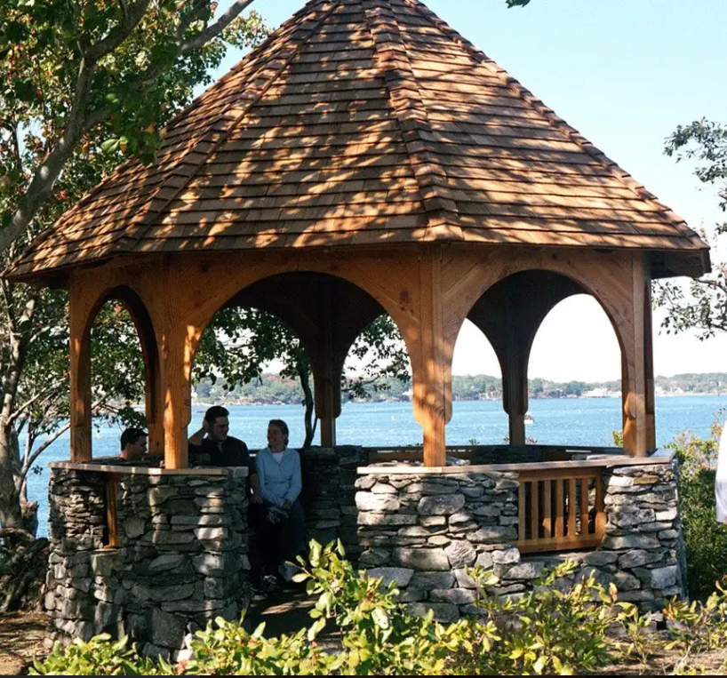
Stevens made about 12 Shingle style cottages intended to be compatible with the island’s natural beauty, as well as a recently-restored gazebo. The largest cottage was the Charles M. Hays Cottage, designed for the then-president of the Grand Trunk Railroad, which Stevens created in partnership with his son John Howard Stevens. (Hays died 2 years after the house was built, as a passenger on the Titanic).

Charles M. Hays Cottage (1909-10)

Charles M. Hays Cottage (1909-10)

Cushing Island gazebo restored by Taggart Construction

Cushing Island gazebo restored by Taggart Construction

The death of Captain Lemuel Moody

Captain Lemuel Moody died on August 11, 1846, and was buried the following day in Eastern Cemetery, at the bottom of the hill on which his Observatory stands. The following is the obituary that was published in the Portland Advertiser on August 12, 1846.

Listen to Moody’s great-great-great-great grandson John York read his obituary at the Observatory here.

moodyportrait.jpg

We lament to have to record this day the sudden death of our respected townsman, Capt. Lemuel Moody, who died in a fit early this morning. Capt. Moody was the son of Enoch Moody and Ann Weeks, and was born in Portland, June 30, 1767; he was consequently past 79 years of age. His father came from Newbury, and built in 1740, the two story wooden house near the corner of Congress and Franklin Street, which is the oldest house in town, and where the subject of this article was born.

Capt. Moody, like the sons of most of our old families, the Prebles, McLellans, Weeks, Tuckers, &c., embarked on the sea for a livelihood.  Our people were thoroughly commercial, their whole energies were employed from their earliest settlement in pursuits connected with the ocean; and our enterprising young men were therefore naturally drawn to that department of life as affording at once the most sure and speedy, and at the same time the most exciting means of advancement in the world. And we do not hesitate to say that no place on the margin of any ocean, has furnished a finer race of hardy, skillful and successful mariners than our own port.

Moody’s tomb

Moody’s tomb

Capt. Moody followed the seas for many years with reputation and success; and forty years ago, he took an active part in getting up an association for the erection of the Observatory, over which he had presided nearly the whole time; keeping a careful watch through his telescope of all occurrences within the range of its vision, and often furnishing the earliest information in regard to disasters happening on our coast, by which effectual relief has been seasonably afforded.  And during all that period, constantly sweeping the horizon, his signals have reported to their owners the approach of their vessels.  At the same time he has kept accurate tables of the weather, notices of which have repeatedly appeared in our paper. – Nor is this the extent of the benefit he has conferred upon the maritime interest; the whole was crowned by the publication in 1825 of a very carefully prepared chart of Casco Bay, with soundings of the coast, from the mouth of the Saco, to the mouth of the Kennebec, and of the principal channels and harbors.

He imparted freely and kindly to all who sought it, information in regard to the harbors and coast, and on the subjects with which he was familiar, and none could leave his company without a favorable impression of the results of his gathered observation, and of the benevolence of his character.

He died in the strength of his intellect and the mellowed ripeness of his affections; he will leave a space in this community which it may not be easy to fill.  It is an interesting fact, and well worthy of notice, that this very morning, previous to his death, he was on top of this Observatory, taking his accustomed observations around the horizon; thus making his final survey over the ocean and land, in the freshness of this beautiful morning, before taking leave of them forever, to enter upon a brighter and better world to which the telescope of his heart has long been directed.

View of Munjoy Hill, Portland, artist unknown, c.1840 (Collection of the Portland Museum of Art)

View of Munjoy Hill, Portland, artist unknown, c.1840 (Collection of the Portland Museum of Art)

Munjoy Hill Local Historic District

Did you know that the protections of the historic district have been temporarily in effect since the Historic Preservation Board recommended the district move forward last year? Several projects have already been reviewed and approved by the Historic Preservation Board with these protections in place, demonstrating that adding new housing units, incorporating modern additions, and incorporating solar panels are all possible in a Historic District!

49 St. Lawrence Street

Architectural rendering of 49 St. Lawrence Street with new additions and rehabilitated front facade. Mark Mueller Architects

Architectural rendering of 49 St. Lawrence Street with new additions and rehabilitated front facade. Mark Mueller Architects

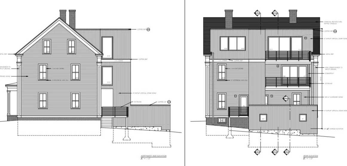
The current owner of the building is proposing to convert the 2 ½ story wood frame residence from three units to four units. The project is prompted by a number of goals, including a desire to increase the number of units within the building, convert the attic area into useful living space, improve the layout and functionality of each floor, and address the generally deteriorated condition of the house. The existing structure was built c. 1858 and is typical of the architecture that characterizes much of Munjoy Hill with its wood frame construction, simple mass and scale, and gable-end-to-the-street orientation. The building is a vernacular expression of the Greek Revival style with most of its architectural detail covered by the application of replacement siding in the late 20th century.

In working to meet the client’s goals, the project architects found that they needed to introduce a stair tower addition to comply with code requirements triggered by the project. The project includes: new cementitious clapboard siding, corner boards, new windows and window openings, new doors, refurbished entry stairs with new treads, risers and code-compliant railings, and a standing seam metal roof. New additions include the stair tower, shed dormers, and entry porch. A rear addition is proposed to replace existing rear decks, stairs and porch addition and will accommodate an elevator. Solar panels are to be installed on the roof. The project was approved by the Historic Preservation Board in early March.

9 Howard Street

9 Howard Street existing conditions.

9 Howard Street existing conditions.

The two ½ story, wood frame residential structure at 9 Howard Street represents a building type, form and style that dominates much of the Munjoy Hill neighborhood. The building was built in 1881 and exhibits the proportions and architectural details generally associated with the Italianate style, including prominent bays on the front and south elevations, an oriel window on the north elevation, tall windows, and a prominent projecting cornice with eave returns. Instead of a bracketed hood over the front entry, there is a flat-roofed portico supported by square columns and pilasters and featuring a wide frieze. It is likely that the front portico is a later alteration as the entry off the rear ell features a typical Italianate bracketed hood.

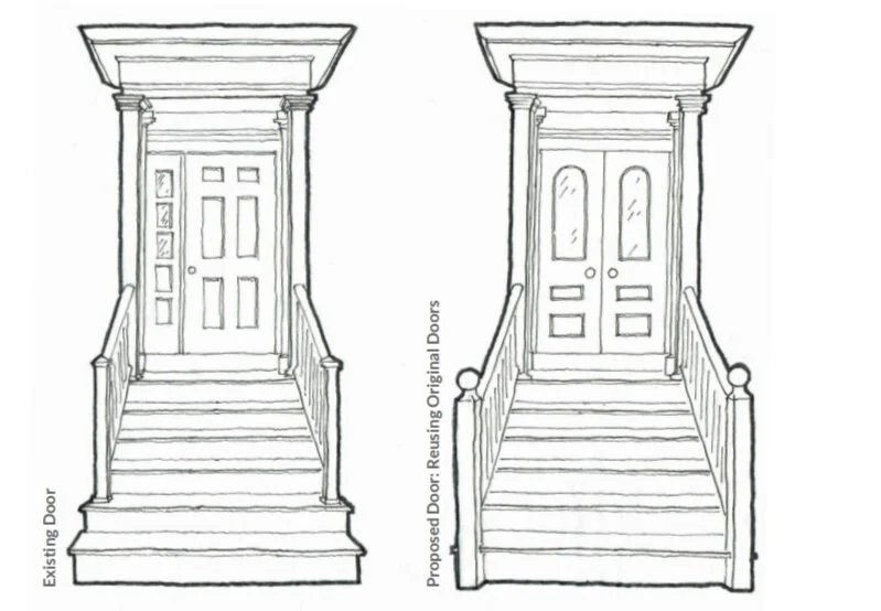
The project includes new dormers, windows, and the rehabilitation of the front entry. At the front entry, the single door and sidelight will be replaced with double-doors, consistent with original appearance and the existing porch railings will be replaced or reconfigured to extend to the bottom stair. New posts with turned ball finials (matching the documented design) will replace existing posts. The application was submitted on January 29th and approved on March 24, 2020.

Before and after design for the front entrance at 9 Howard Street. Blue Anchor Designs

Before and after design for the front entrance at 9 Howard Street. Blue Anchor Designs

24 St. Lawrence Street

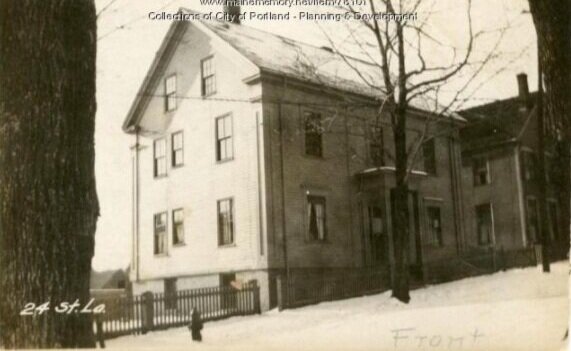
This 1924 Portland Tax assessor image documents the early look of the dwelling. This photographic collection is a great resource for homeowners. You can search for your home!

This 1924 Portland Tax assessor image documents the early look of the dwelling. This photographic collection is a great resource for homeowners. You can search for your home!

This project includes a new garage and a multi-story rear addition. The project proposal also includes extensive exterior rehabilitation of the original 1851 Greek Revival side gable, two-family dwelling. A previous proposal to demolish the house and build a multi-unit condominium building was withdrawn following classification of the house as Preferably Preserved under the Munjoy Hill Neighborhood Conservation Overlay District ordinance, permitting issues, and neighborhood opposition.

Part of the early wave of development on the south side of Munjoy Hill after the founding of the Portland Company and the Atlantic & St. Lawrence Railroad, the dwelling is a contributing building in the proposed Munjoy Hill Historic District. The current owners purchased the property in July 2019. The project will demolish the existing one-story, hip-roofed, single-car detached garage and an existing deck and stair structure attached to the rear of the house, and construct a new garage. The new two-car garage will be connected to the rear of the house by a new deck and stairs. A new elevator will rise from the garage to a new third-floor dormer on the rear roof plane of the house and connect to the house by upper floor hallways. All of the proposed construction is on the rear of the house; the front of the building will be rehabilitated. The project was applied for in late January and approved less than two months later in March 2020.

The house at 24 St. Lawrence Street will remain largely as is, but a modern addition will be built at the rear, along with a new garage. Sheri Winter, architect.

The house at 24 St. Lawrence Street will remain largely as is, but a modern addition will be built at the rear, along with a new garage. Sheri Winter, architect.

34-36 North Street

This project features a second floor addition to an existing one-story bay to add more light to the owners’ living space. This two-family, wood-framed residence is a fairly simple transitional Queen Anne designed by John Calvin Stevens and built in 1882. It closely resembles 38 North Street next door, also designed by Stevens. 34-36 North Street is classified as a contributing structure in the proposed Munjoy Hill Historic District, while 38 North is listed as noncontributing because of numerous alterations to the original fabric. Nevertheless, the strong resemblance between the two houses is still evident, and the still extant original two-story bay at 38 North Street provided valuable design clues for the proposed project. The owners applied for the project on January 7, 2020 and it was approved by the Historic Preservation Board with conditions a few weeks later on January 30th.

Before and after drawings of the proposed exterior changes. Dextrous Creative

Before and after drawings of the proposed exterior changes. Dextrous Creative

Benefits of Living in a Local Historic District

Exchange Street in the Old Port Historic District (Photo by Corey Templeton)

Exchange Street in the Old Port Historic District (Photo by Corey Templeton)

By Mark McDonnell, 2020 Intern

Each summer, Greater Portland Landmarks hires interns currently enrolled in historic preservation programs at colleges across the country to assist in our advocacy and education work. Our interns bring their knowledge of the preservation world in academia and in other parts of the country. In return, they gain valuable experience working in a historic preservation non-profit. This year, they’re working remotely.

Mark was raised in New Jersey and is enrolled in the Preservation Studies M.A. program at Boston University.

What is a Local Historic District?

Historic districts fall under two major types: National Register Historic Districts (NRHDs) and Local Historic Districts (LHDs). LHDs protect and regulate the buildings within them, while NRHDs are more useful for identifying historic resources and securing federal funding for rehabilitation of these structures. The impact of a LHD on the homeowner can be greater than that of the NRHD, but there are some similarities. For example, both types of historic districts can promote tourism. The NRHD might seem more appealing to the homeowner because it lacks the regulatory power of the LHD, but LHDs offer plenty of benefits as well, and common concerns about their negative impacts do not hold up against the data.

Local historic districts (LHDs) are defined and regulated areas containing groups of properties that have been determined to contribute to a municipality’s culture or heritage. Generally, street-facing facades of buildings in LHDs cannot be significantly altered, but interior changes and exterior alterations not visible to the public are usually approved by the LHD’s regulatory body. Local historic districts preserve the historic character of an area with tools such as demolition delay and design review. Likewise, new construction in or near a LHD might be subject to design requirements or otherwise be encouraged to be compatible with nearby historic construction. Living in a LHD can provide environmental and economic benefits, among others.

Environmental Benefits

Rehabilitating a building on Commercial Street in the Old Port Historic District (Photo by Corey Templeton)

Rehabilitating a building on Commercial Street in the Old Port Historic District (Photo by Corey Templeton)

Local historic districts benefit the environment by maintaining and reusing historic buildings rather than demolishing and replacing them. Using an already-existing building is better for the environment than new construction, even if the new construction would be energy efficient. Reusing an existing building that has outlived its original purpose is called “adaptive reuse.” Adaptive reuse is almost always better for the environment than new construction because fewer materials need to be made, transported, or assembled. Local historic districts are inherently “green” because they encourage the use and reuse of already-existing buildings rather than demolition and new construction.

Economic Benefits

Economic benefits of owning a home in a local historic district are well-documented, contrary to popular concerns that regulations governing a LHD might lower property values. In fact, property values in historic districts appreciate faster than in surrounding areas that are not designated historic districts. “City or regional studies where historic districts are compared to non-historic districts have provided generally conclusive data regarding the history of property value increases over time in historic districts that exceed the rate of growth in non-historic districts.”[1] For example, a 2011 study of single-family homes in Connecticut towns, conducted by the Connecticut Trust for Historic Preservation, found, “Overall there appears to be a 2-4% value premium from location within a local historic district.”[2] This positive effect on property values is exaggerated in urban areas. In New York City, the value premium ranges from 8% in the bottom quantile of house prices to 5% in the highest.[3]

A snowy day in the Deering Street Historic District (Photo by Corey Templeton)

A snowy day in the Deering Street Historic District (Photo by Corey Templeton)

While property values appreciate faster in historic districts than outside them, there is no evidence that this causes gentrification or other displacement, despite several studies evaluating exactly this possibility. The largest of these studies found that “nothing happens” regarding demographic changes connected to historic designation. Any demographic change that occurs in the area within a decade of historic designation, the authors conclude, is unrelated to the historic designation.[4]

Historic districts offer economic and environmental benefits. Using and reusing existing buildings is a major environmental, and potentially financial, benefit in itself. Likewise, the positive effect of historic district designation on property values is well established, despite common concerns about regulations. Historic districts preserve a town or neighborhood’s historic character while providing many important benefits to their residents and to the environment.

References

[1] Mimi Morris, “The Economic Impact of Historic Resource Preservation,” California Cultural and Historical Endowment, November 2012: 13, https://resources.ca.gov/CNRALegacyFiles/docs/cche/EconomicImpact_of_HistoricResourcePreservation.pdf.

[2] PlaceEconomics, “Connecticut Local Historic Districts and Property Values,” Connecticut Trust for Historic Preservation, October 2011: 3, http://lhdct.org/documents/Property%20Values%20LHD%202011.pdf.

[3] Edward L. Glaeser, “Preservation Follies: Excessive Landmarking Threatens to Make Manhattan a Refuge for the Rich,” City-Journal, Spring 2010, https://www.city-journal.org/html/preservation-follies-13279.html.

[4] N. Edward Coulson and Robin M. Leichenko, “Historic Preservation and Neighbourhood Change,” Urban Studies 41, no. 8 (July 2004): 1587, https://buprimo.hosted.exlibrisgroup.com/permalink/f/g23ind/TN_sage_s10_1080_0042098042000227028.

Further Reading

“National Park Service Historic Preservation Economic Impact.” National Park Service. Updated January 11, 2015, https://www.nps.gov/subjects/historicpreservation/economic-impacts.htm.

Rypkema, Donovan, Caroline Cheong, and Randall Mason. “Measuring Economic Impacts of Historic Preservation: A Report to the Advisory Council on Historic Preservation.” November 2011. https://www.achp.gov/sites/default/files/guidance/2018-06/Economic%20Impacts%20v5-FINAL.pdf.

Zahirovic, Velma, and Swarn Chatterjee. “Historic Preservation and Residential Property Values: Evidence from Quantile Regression.” Urban Studies 49, no. 2 (February 2012): 369-382. https://buprimo.hosted.exlibrisgroup.com/permalink/f/g23ind/TN_sage_s10_1177_0042098011404936.

Resurgam Birthday Cake

Chloe Martin, Landmarks’ former Office and Communications Coordinator, is a talented baker. She created a unique cake to celebrate the bicentennial inspired by Portland and Maine, and shared the recipe with us:

When I was asked to make a cake for Landmark’s Maine Bicentennial Celebration my inspiration started at the old Eastland Hotel and then took me on a journey to Denmark, through my family history, on to the potato fields of Presque Isle, and back down to Portland’s Great Fire of 1866. The result was a moist chocolate fudge cake with toasty meringue topping.

Ingredients

Cake:
4 TBS (56 g) butter, room temp (half stick)
½ cup (100 g) granulated sugar
2 TBS (25 g) brown sugar
2 oz (56g) potato, boiled and mashed till smooth
1 egg
1 egg yolk (save the white for later)
½ cup + 2 TBS (87 g) all-purpose flour
2 TBS (10g) cocoa powder
1 ½ tsp baking powder
¼ tsp salt
¼ cup + 2 TBS buttermilk (or milk with 2tsp lemon juice)

Toasty Topping:
4 egg whites
1 cup (200g) granulated sugar
¼ tsp cream of tartar

Scrape down the sides of the bowl after each ingredient is added. In the bowl of a stand mixer fitted with the paddle attachment or in a large bowl with a hand-held mixer, cream butter and sugar until light and fluffy. Add mashed potatoes and mix until well-incorporated. Beat in the egg and egg yolk. With the mixer on low, drizzle in melted chocolate. In a separate bowl whisk or sift together flour, cocoa powder, baking powder, and salt. With the mixer on low speed alternate adding the dry ingredients in thirds, with half the milk, starting and ending with the dry.

Spray an 8x8 metal pan with grease. Line with two pieces of parchment with overhang in opposite directions to create a sling to make it easier to take the cake out. Scrape the batter into the prepared pan and set aside while you make the meringue topping.

Heat the oven to 325 degrees F. In the clean bowl of a stand mixer fitted with the whisk attachment, add the egg whites and cream of tartar. Beat on medium-low until foamy. Turn the mixer up to medium and very slowly add sugar with the machine running. After the sugar is added, turn the machine on high and beat until stiff peaks form. Save ¼ cup meringue for later. Scrape the rest of the meringue on top of the cake batter and spread out, pressing some meringue into the batter and forming dramatic swoops of meringue. Bake for 45-55 minutes until a toothpick comes out mostly clean with a few wet crumbs, turning half way through.

When the cake is done, remove from oven and turn on broiler. Use the meringue set aside to patch up any holes made in the topping when testing the cake. Put the cake under the broiler for 2 minutes, or until the meringue peaks get toasty to your liking. Remove cake from oven, let cool completely and use parchment paper sling to take cake out of pan. Enjoy!

Cake picture.jpg
Chloe-horizontal.jpg

Portland's Changing Waterfront

An image of the Portland waterfront c1900. Image from the Maine Historical Society’s Maine Memory MMN#13916

An image of the Portland waterfront c1900. Image from the Maine Historical Society’s Maine Memory MMN#13916

is our historic waterfront at Risk?

Portland’s central waterfront extends along the south side of Commercial Street, from Deake’s Wharf in the west to Maine Wharf in the east. This central zone has been a significant economic and cultural asset for over 350 years. It is the largest resource for commercial vessel berthing in Portland Harbor, sitting between the western waterfront (featuring deep sea berthing and dedicated to freight and industrial uses) and the eastern waterfront (a transportation hub with facilities for cruise ships and ferries). The central waterfront is the heart of our tourism industry as well as the core of the city’s working waterfront.

Figure 1. Portland’s waterfront in 1776. Courtesy of Rosemary Mosher and Osher Map Library.

Figure 1. Portland’s waterfront in 1776. Courtesy of Rosemary Mosher and Osher Map Library.

Figure 2. NOAA’s projected inundation map of Portland with a ten-foot surge.

Figure 2. NOAA’s projected inundation map of Portland with a ten-foot surge.

The central waterfront we know today is filled land, built to facilitate a railroad connection between the east and west ends of the city. This makes the area particularly vulnerable to increased storm surges, high tide events, and projected sea level rise. Modern flood and storm surge projections show the extent of possible flood waters mirrors the known historical shape of the peninsula. A composite map showing the peninsula’s coastline in 1776 versus today (Figure 1) is closely replicated by NOAA’s Sea Level Rise Viewer when predicting a ten-foot surge in sea level (Figure 2). NOAA classifies the entire central waterfront as “highly vulnerable”.

Figure 3. Tidal flooding on Portland Pier has been occurring for many years.

Figure 3. Tidal flooding on Portland Pier has been occurring for many years.

A 2013 Flooding Vulnerability Assessment for the Commercial Street waterfront area predicted the cumulative expected storm damage to the value of all buildings and improvements between 2013 and 2050 to reach $32.9 million. According to that assessment, in 2050, buildings on every wharf from the Portland Fish Pier to the Maine State Pier are vulnerable to significant damage. Buildings on Widgery Wharf and Portland Pier, two of the Central Waterfront’s most historic wharves, are at risk of being permanently inundated due to sea level rise by 2050. Portland Pier (which has some of the Central Waterfront’s most historic structures), has historically been particularly prone to flooding (Figure 3).

Early History of Central Waterfront - Infilling and the Creation of COMMERCIAL Street

Figure 4. From a 1826 manuscript map titled Portland with a view of the different streets by Lemuel Moody (1767-1846) features the city streets and designations, as well as buildings, wharves and rope walks. Portland wharves extend from Fore Street,…

Figure 4. From a 1826 manuscript map titled Portland with a view of the different streets by Lemuel Moody (1767-1846) features the city streets and designations, as well as buildings, wharves and rope walks. Portland wharves extend from Fore Street, then the shore line along the central waterfront.

By the end of the eighteenth century, Portland was a booming center of trade, supported by its lumber trade and fisheries as well as the rise of the molasses trade. Trade with the West Indies became quite lucrative for Portland, who exported a wide array of wood products in exchange for the sweetening agent. Molasses was a common dietary staple and used in rum production.

The area around today’s central waterfront was a bustling commercial and cultural center. Merchants and tradesmen relied on the sea to ship and trade cotton, flour, salt, fish, tobacco, wine, rye, glass, and lumber in several forms. Store owners, shipbuilders, blockmakers, silversmiths, blacksmiths, and distillers operated on the waterfront. At the time, the wharves that had sprung up following the Revolution were breastworks, or rudimentary docks made of piled lumber, rubble, and stones. A more substantial, permanent wharf was required to accommodate traffic coming in and out of the harbor.

In 1793, a group of 25 sea captains and merchants formed a group, calling themselves the “Proprietors of Union Wharf.” They set out to build an appropriate structure on a breastworks that sat at the foot of Union Street. The resulting wharf had no comparison in the harbor. The 110-foot wide structure sat upon a base of rocks, dirt, and other fill material, which supported massive oak pilings covered with wooden planks. Over 3,500 tons of lumber was used to construct the wharf, which boasted a 48-foot-wide passageway through its center. The wharf was promptly populated with ten or so businesses. Other wharves quickly took form and by 1806 Portland had emerged as the sixth largest seaport in the country.

Figure 5. Portland Public Works overlay maps circa 2001 depict the evolution of the Portland waterfront. The blue lines depict the original shoreline close to Fore Street.

Figure 5. Portland Public Works overlay maps circa 2001 depict the evolution of the Portland waterfront. The blue lines depict the original shoreline close to Fore Street.

The mid-eighteenth century and the rise of railroads brought about the most dramatic physical transformation of the waterfront’s history. Access to Canadian ports was limited during the winter months due to the St. Lawrence River freezing over. In an attempt to lure Canadian trade to Portland, Board of Trade leader John A. Poor spearheaded the effort to extend Canada’s Grand Trunk Railway from Montreal to Portland. Poor espoused Portland Harbor’s natural advantages and the half-day of travel time that could be saved by choosing it over Boston or New York. The Atlantic & St. Lawrence Railroad, later taken over by the Grand Trunk, brought car loads of grain to Portland from Canada and the West for reshipment.

In order to link the Canadian Grand Trunk Railway to the Portland, Saco & Portsmouth Railroad terminal at the foot of High Street and Portland’s wharves, city’s leaders agreed to build a new road with tracks down its center running perpendicular to the waterfront’s docks. Completed in 1853 for $80,000, Commercial Street was 100 feet wide and nearly a mile long, and was constructed on filled land in the harbor east of Fore Street (which originally followed the shoreline). The road was constructed through the middle of existing wharves, and obscured smaller wharves completely (Figure 6). As a result, businesses that were once dockside now had a new street between them and the water, and other lots were lost completely. Wharves lost hundreds of feet of berthing space and building space.

Figure 6. An 1852 map of Portland shows the construction of Commercial Street on the Waterfront before the land between Fore and Commercial Streets was completely filled in.

Figure 6. An 1852 map of Portland shows the construction of Commercial Street on the Waterfront before the land between Fore and Commercial Streets was completely filled in.

Figure 7. On an 1858 Map of Portland, just five years after the completion of Commercial Street, five wharves (Union, Dana’s (Merrill’s), Brown’s, Smith’s, and Berlin Mills) had built connecting tracks to take advantage of increased trade opportunit…

Figure 7. On an 1858 Map of Portland, just five years after the completion of Commercial Street, five wharves (Union, Dana’s (Merrill’s), Brown’s, Smith’s, and Berlin Mills) had built connecting tracks to take advantage of increased trade opportunities.

On new or extended wharves, businesses quickly took advantage of the presence of the new railroad along the waterfront. Within five years of Commercial Street’s completion, connecting tracks were built down the lengths of several wharves (Figure 7). Canada’s grain was exported from the port, while lumber, shipbuilding, molasses, and fish remained important industries.

The wharves on the central waterfront were all constructed as working piers (as opposed to pleasure piers), specifically intended for the docking, loading, and unloading of vessels. The area’s wharves are largely fill supported, often with wood pylons supporting the apron (outer edge) and terminating end, farthest from Commercial Street. Wharf builders obviously made use of Maine’s abundant supply of granite and pine during their construction. Structures on the wharves vary drastically in scale from 100,000 square-foot masonry factories to 8-by-10-foot wood-frame fish houses. From early images we know that many wharves were paved with granite paving blocks.

The 20th Century - A crumbling waterfront

Portland’s waterfront at the turn of the century was populated by ferry terminals, steamship docks, lumber yards, coal companies, cooperages, and cold storage facilities.

Figure 8. Portland Cold Storage Co. circa 1905.

Figure 8. Portland Cold Storage Co. circa 1905.

Portland Cold Storage Co. was located at 188 Commercial Street on Central (now Chandler's) Wharf. Founded in 1905, the cold-storage firm was managed by James C. Poole (1845-1924) of Boothbay Harbor (Figure 8, pictured standing at left). In 1915, Poole formed another cold storage company on Union Wharf. Train tracks allowed rail cars to be loaded and unloaded right outside the storage building.

Figure 9. A 1900 advertisement for Berlin Mills Co lumber yard and planing mills. Upper right is now Gowen Marine/Portland Yacht Services (Becky's Diner would be to the left of the image). Image to lower right is at the north corner of High and Comm…

Figure 9. A 1900 advertisement for Berlin Mills Co lumber yard and planing mills. Upper right is now Gowen Marine/Portland Yacht Services (Becky's Diner would be to the left of the image). Image to lower right is at the north corner of High and Commercial Streets, now the Rufus Deering Lumber/Hobson’s Landing development.

On the western end of the central waterfront was a large lumber yard, the Berlin Mills Company. In 1851 the St. Lawrence & Atlantic Railroad, later changing its name to Grand Trunk Railway, entered Berlin, New Hampshire. The chance to build a saw mill in Berlin came in 1852 when a group of Portland, Maine businessmen, John B. Brown, Josiah S. Little, Nathan Winslow and Hezekiah Winslow, recognized that the construction of the railroad line through Berlin was a great way to import and export wood products in and out of town. Acquiring water, timber and rail rights, they formed a partnership under the name H. Winslow & Company, which changed its name to Berlin Mills Company in 1868. In Portland the company had a planing mill and wharf for shipping lumber.

In 1889 the Canadian Pacific Railway opened a rail line across the state of Maine from Montreal to Saint John, New Brunswick, transferring the majority of Canada’s transatlantic passenger and cargo shipping to the Saint John during the winter months. This resulted in a loss of Canadian trade revenue in Portland, and Portland lost its standing as a leading regional seaport. The Great Depression in the 1930s caused additional hardship on Portland’s waterfront.

World War II briefly gave the city and its waterfront an economic boost. Portland Harbor became the base of the entire North Atlantic fleet, complete with 30,000 shipyard workers and anchorages filled with Naval destroyers and support vessels. Waterfront merchants profited from the presence of shipyard workers and sailors on leave. However the economic boom of the war years quickly dissipated when military activities ended.

A 1961 Portland Press Herald series, “Our Crumbling Waterfront,” painted a stark picture of the port, describing rotting pylons, empty buildings, and an economic slump. A focus on downtown redevelopment in the Urban Renewal period of the ‘60s and ‘70s, left no little to no funds to devote to the waterfront. A 1978 National Science Foundation study described Portland’s waterfront as one of the most decrepit on the east coast. The following year, voters and public officials were sympathetic to the waterfront’s plight and approved a $9 million bond to help pay for fish piers in Portland.

Spurred by the completion of the Portland Fish Pier in 1983, new construction projects replaced deteriorating piers and rotting pilings across the waterfront. Condominium construction on Chandler’s Wharf in 1985 and at 40 Portland Pier in 1987 as well as other development proposals led to a 1987 moratorium on all development along the waterfront that was non-marine related. The moratorium was overwhelming approved by Portland voters who wanted to protect the working waterfront from non-marine uses. Since the mid 1980s, the city has been challenged to balance protecting fishing and other maritime industries while also promoting a flexible and varied waterfront for non-marine businesses and development.

Will the waterfront’s future look like its past?

Corey Waterfont.jpg

A 2018 inventory of the waterfront observed that the central waterfront remains a center for marine industry, but continues to evolve as permitted under current land use policies. According to the City’s Comprehensive Plan Portland 2030, there has been significant contraction of the waterfront economy and the ground fishing industry on the central waterfront since the 1990s. Ground fishing vessels have diminished by 50% and there has been a 2/3 reduction in landings at the Portland Fish Exchange. The area has also experienced decreasing water depth at the piers due to natural deposition of sediments, which are exacerbated by storm water overflows into the harbor, requiring maintenance dredging to ensure quality commercial berthing opportunities.

Additional planning initiatives for the central waterfront in the City’s comprehensive plan include: investing in pier infrastructure, and exploring funding for pier maintenance; promoting access to the waterfront for commercial and marine activity, including berthing; supporting traditional and emerging marine industries, requiring collaboration with private pier and waterfront property owners to implement policies that promote and protect the marine economy; and planning for climate change.

If the prediction maps are correct, sea level rise needs to be part of the conversation about the future of development along Commercial Street and on the waterfront. Its historic buildings, infrastructure, and its uses, that are so integral to our city’s character and economy are in danger. Public and private leadership, like that which led to the creation of Commercial Street, is necessary to develop comprehensive planning strategies that will guide owners as they assess the risk to their waterfront assets and to direct investments into more resilient infrastructure. Part of the solution will also need the City’s technical standards and land use code to allow for adaptive construction techniques, storm water infrastructure and utilities, site protection, and floodproofing.

At Landmarks we are focused on collaboration and broad public engagement initiatives with other organizations working to raise awareness of the issue as well as developing proactive and sustainable solutions. You can learn more about our work on our website or take a short virtual tour of the waterfront. Stay tuned for upcoming events this summer that will celebrate the history of our waterfront and how historic preservation and the conservation of existing resources are key to developing a strategy of resiliency, risk management and adaptation which will guide changes on the waterfront in the future.

This fall, Greater Portland Landmarks will host a series of panel discussions about the unprecedented challenges to Maine’s cultural and natural heritage due to our changing climate. Bringing together organizations and community leaders, Staying Above Water will highlight the impact climate change is already having on historic buildings and discuss strategies for future adaptation. Landmarks will publish a booklet of case studies later this summer that explore the impacts of a changing climate on a variety of local building types and suggest mitigation strategies for property owners. We hope you will join us!


by Julie Ann Larry, from research compiled by Tova Mellen in 2019.

Designing for Health in the 19th Century

By Kate Burch

This year’s coronavirus pandemic has transformed our lives and caused us all to reexamine our environments from a hygienic perspective. As we spend more time in our homes and immediate neighborhoods, and try to make our indoor spaces safer, some of the solutions utilized by 19th century architects, landscape architects, engineers and planners that can be seen in Portland are still relevant today.

“Deering’s Woods” in 1878. Photograph by Henry Wadsworth Longfellow.

“Deering’s Woods” in 1878. Photograph by Henry Wadsworth Longfellow.

Portland’s large public parks – Deering Oaks, Lincoln Park, the Western and Eastern Promenades – were all built in the 19th century and continue to serve as significant green space in the city. In a time when we are encouraged to stay close to home due to coronavirus, the same value they had in the 19th century has become apparent. 

The public park movement began in the 1830s to improve the living conditions for workers in crowded industrial towns and cities. Through the 19th century, parks were seen as increasingly important for both hygienic and humanitarian reasons. Parks were referred to as the “lungs of the city” to help against poor air quality and the spread of infectious disease. They were also places where people who lived in crowded conditions and did not have access to travel away from the city could have access to outdoor space for leisure and recreation.

The crowded living conditions of the working class in cities also led to efforts to improve hygiene in housing, which, in the 19th century, focused on improved airflow and increased light. Lower income people in cities often lived in uncomfortable and unsafe conditions such as cellars or large tenements with windowless rooms and shared facilities that led to the fast spread of infectious diseases.

Side Sectional View of Tenement House, 38 Cherry Street, New York City, 1865

Side Sectional View of Tenement House, 38 Cherry Street, New York City, 1865

In the late 19th and early 20th century, reformers led the push for better housing and tenement reform. In New England, the triple-decker house originated as a more livable alternative to tenements or row houses. Triple-deckers offered light and airflow on all sides of a building while still economic to build, and often feature porches for each apartment. In larger apartment buildings, changes in design developed to improve ventilation and hygiene, such as air shafts and increased windows. One popular design was the “h” plan, which can be seen in the Stateway Apartments at 59 State Street in Portland, built by the architectural firm Miller & Mayo in 1913. The shape of the building allows for more outward-facing windows, cross-ventilation, and fresh air for all residents.

59 State Street in 1924

59 State Street in 1924

82 Vesper Street in 1924

82 Vesper Street in 1924

Portland’s 19th century hospitals also reflect this emphasis on sunlight, good airflow, and ventilation. The Maine General Hospital building at 22 Bramhall Street (1874, now Maine Medical Center) was designed by architect Francis Fassett to have 4 pavilions around a central wing. This design, coupled with the building’s location atop Bramhall Hill, allowed for free circulation of fresh air to prevent disease, as well as scenic views of the White Mountains and the ocean to improve patients’ spirits.

Sketch of Francis Fassett’s original proposal for Maine General Hospital, c1872

Sketch of Francis Fassett’s original proposal for Maine General Hospital, c1872

Portland Marine Hospital (now Martin’s Point), 2012. Photo by Corey Templeton.

Portland Marine Hospital (now Martin’s Point), 2012. Photo by Corey Templeton.

The Portland Marine Hospital (1855, now Martin’s Point Healthcare) was designed by architect Ammi B. Young in an “h” plan to allow for maximum sunlight and ventilation. Its location – similar to Maine General, on a hill atop a peninsula by the ocean – improves airflow and corresponds to 19th century thinking that sea air was good for health.

These 19th century design values for health and well-being have proven to be lasting. Fresh air, good ventilation, and exposure to UV rays in sunlight are some of our key weapons to fight the coronavirus pandemic. As people are confined to their homes or encouraged to travel only locally, features like windows, porches, and public parks are still crucial to our 21st century lives.

What Will Historic Preservation Look Like Tomorrow?

by Julie Larry

It’s hard to predict the future, especially now when even predictions for next month are at best wild guesstimates. When I was a kid I thought the future would be like the Jetsons. While telemedicine is more common now, I am still waiting for my flying car and a robot maid to clean up around the house. I could really use the robot, but the flying car I can live without. Unlike George Jetson, I am working from home these days.

Elroy Jetson ‘sees’ the doctor.  Credit: Hanna Barbera

Elroy Jetson ‘sees’ the doctor. Credit: Hanna Barbera

So what will Landmarks be advocating for in the future? Two topics at the top of my list are interrelated and the third is a topic that Landmarks has been an advocate for since our early years.

  1. Be Prepared.

    We can’t prepare for all contingencies, but as historic building owners, we should be prepared for fire, storm events, and natural disasters. Across the country preservationists are working with state and local governments as well as homeowners to prepare for hurricanes, tornadoes, wildfires, and earthquakes. Closer to home, one of Portland’s local Landmarks, Etz Chaim Synagogue, home to the Maine Jewish Museum, suffered a fire late last week. Luckily the building was saved, but there was damage to the building’s interiors and contents.

    Homeowners can face some of the most immediate impacts of disasters: temporary housing needs, loss of and damage to our personal belongings, financial uncertainty, and stress.  You can effectively reduce the risk of these impacts with good planning.  There is a great deal of online information to help homeowners reduce the risk of fire, minimize the impacts of flooding, and strengthen a home's resistance to extreme wind, rain and other climactic forces. The National Trust for Historic Preservation’s disaster preparation resource guide is a good place to start.

  2. Be Resilient.

    Historic preservation and resiliency advocates share a common goal, to protect assets and maintain them for the long term. We need to do our best to prevent building decay, incorporate flexibility and adaptability into our buildings and communities, fortify buildings and neighborhoods against climate change and energy shortages, increase building durability, increase the use of local materials, and reject planned obsolescence in our buildings.

    I can hear my Yankee grandparents, who grew up during the Great Depression, in my head telling me these ideas are only common sense!

    Building maintenance, adaptive use, and use of locally sourced or salvaged materials have been part of historic preservation’s toolkit for decades. To include climate adaptability and sustainable building practices is a natural extension of our current advocacy work. Historic preservation isn’t the solution, but it can and should be part of any solution to make our homes and communities more resilient.

  3. Good Design.

Well designed buildings and well built communities that respond and adapt to our changing needs is something for which Landmarks has long been an advocate. That is unlikely to change in the future, especially given point #2 above. In the last decades, we have seen a steady rise in demand for neighborhoods and communities with safe and friendly streets, mature trees, and walk-able access to services like schools, coffee shops, and small neighborhood stores. Most historic neighborhoods in greater Portland include a variety of housing options with easy access to a local business node that serve as models for planning developments and future zoning initiatives.

We must advocate for future landmarks. Historic preservation and new architectural design are not in opposition to each other, but are in fact very much related, connected by an interest in architecture, history, and the future. New buildings should be designed to outlast a single tenant or owner, repairable, and be adaptable to new uses and needs. We will continue to be advocates for buildings constructed with substantial materials, careful detailing, and a recognition that they will need to change and adapt over their lifetimes like their historic neighbors.

Credit: Corey Templeton

Credit: Corey Templeton

What do you think the future holds? What should Landmarks be focusing on in the future? We will be resuming our strategic planning later this years, so let us know in the comments what you think we should be planning for in our near future.

Architect of the Week: Ellen Louise Payson

By Alessa Wylie

Screen Shot 2020-05-26 at 1.18.28 PM.png

Ellen Louise Payson (1894-1977) known to family, friends and clients as Louise, is considered a pioneer of American landscape architecture. She gained widespread recognition during the 1920s and '30s as an accomplished landscape architect “for the soundness with which she applies to her gardens the principles of landscaping and architecture … and for the sympathetic feeling for varying material which her work always shows.”

Louise Payson was born in Portland, Maine, the daughter of Edgar Robinson Payson and Harriet Estabrook Payson of the prominent Payson family. She was four years old when her mother died of typhoid fever and her father’s sister Jeannette came to live with the family. Aunt Jeannette and her close friend and companion, Annie Oakes Huntington would play an important role in Louise’s life. Aunt Jeannette loved to travel and Annie Oakes Huntington was a well-known botany expert whose 1902 book Studies of Trees in Winter was so successful it was reprinted three times and used as a textbook at the Yale School of Forestry. These two women greatly influenced Louise throughout the years.

Cover of a 1920s brochure for the Lowthorpe School

Cover of a 1920s brochure for the Lowthorpe School

Payson attended the Lowthrope School of Landscape Architecture, Gardening and Horticulture for Women in Groton, Massachusetts. It was the only landscape architecture program available for women in the United States at the time. Students studied architecture and landscape history, drawing, drafting, surveying and site engineering, principles of construction, along with plant material, forestry, botany, and entomology. The school was located on a 17-acre estate that included a fruit orchard, flower and vegetable gardens, meadow and pastureland and a small arboretum of trees and shrubs that provided a place for plenty of practical, hands-on experience.

Louise Payson graduated from the Lowthrope School in 1916 and went to work for landscape architect Ellen Shipman. Shipman had started her business in New Hampshire in 1912 and eventually expanded to open an office in New York City. She only employed women and provided professional opportunities that allowed many of them to set up successful practices of their own like Louise Payson did in 1927. Shipman wrote “Louise Payson came fresh from Lowthorpe, so young and full of ability, and after twelve years with me, started out brilliantly for herself.”

In the beginning of Louise’s career, she created landscape plans for family members in Portland’s Western Prom neighborhood and in Falmouth Foreside. The earliest known surviving drawing is a design for her father at 83 Carroll Street in 1917. The house was a semi-detached residence designed by local architect George Burnham (the subject of last week’s architect spotlight.) The Payson’s lived in the eastern half on the corner of Carroll and Chadwick Streets. To create the gardens Louise used a variety of small-scale shrubbery showing not only her knowledge of plants but also her understanding of the size of the yard.

Planting plan for E.R. Payson, Portland

Planting plan for E.R. Payson, Portland

That same year Louise also designed a 33 by 70-foot perennial garden for her Uncle Charles in Falmouth Foreside choosing plants that she would continue to use throughout her career. Additionally, many of Louise’s drawings include maintenance information. “Very important for the success of the garden is the careful staking. The plants much not be tied to the stakes, but the stakes placed around the plant or group of plants of the same variety, and raffia tied to the stakes leaving the plants free in the center.”

Enclosed perennial garden for Charles Payson, Falmouth Foreside

Enclosed perennial garden for Charles Payson, Falmouth Foreside

Cumberland Foreside heart-shaped garden

Cumberland Foreside heart-shaped garden

Louise Payson left Ellen Shipman’s office in 1927 and started her own practice in New York City, where she followed Shipman’s practice of hiring only women. She maintained her office from 1927 through 1941 and completed over seventy commissions, designing the grounds of several large estates in Connecticut and New York, including the estate of her cousin Charles S. Payson. Her smaller projects included a hidden, heart-shaped garden for her cousin in Cumberland Foreside as well as other gardens in New England, New York, New Jersey, Pennsylvania and as far west as Missouri.

Although there was a great range in the scale of her projects, there was a consistency and symmetry in her designs that also reflected her extensive knowledge of plant material and her engineering ability. In addition, she designed fences, buildings, and trellises with a sensitivity to the architectural style of the residence.

In 1931 Payson joined the American Society of Landscape Architects (ASLA) and her design for the John P. Kane Estate in Locust Valley, NY was included in the 1934 Yearbook of Members Work and several other of her projects from this period  were published in House Beautiful, House and Garden and Home and Field.

Judith B. Oliver (seated) in her Ogunquit garden designed by Lousie Payson

Judith B. Oliver (seated) in her Ogunquit garden designed by Lousie Payson

House and Garden also selected a Louise Payson-designed landscape in their 1933 “Little House” competition. The idea was to inspire readers of the possibilities for their own dream house with an imagined site that was a corner suburban lot, 60 by 150 feet. Architects designed a small Georgian house with French influences and Louise’s design divided the lot into five areas to utilize all the available space.

Despite the Great Depression, Louise continued to receive commissions throughout the Northeast. They varied tremendously in scale and type from large estates to roof-top gardens in Manhattan. She closed her office in June 1941 and as U.S. involvement in World War II intensified, she worked at Eastern Aircraft in Pennsylvania to support the war effort. In 1944 she sailed to Portugal to volunteer in Lisbon as a relief worker.

When she returned 17 months later, she didn’t open an office but she did continue to design gardens mostly for family and friends. She also didn’t charge them, instead she asked that a donation be made to one of her favorite organizations including the National Society of Colonial Dames of America in the State of Maine, The Victoria Society of Maine, The Longfellow Garden Club, and the Maine Audubon Society.

In 1951 she purchased a farm in Windham and planted extensive gardens, dividing her time between the farm and her Portland home. She remained active in various organizations and traveled extensively. She died unexpectedly in 1977 at the age of 82 while on a Mediterranean cruise.

As a woman practicing in what historically had been a male-dominated field, Louise Payson helped redefine the character and qualities that established the distinctiveness of American gardens and estates during what is know as the “Golden Era of American Landscape Architecture.”

Shortly after her death family members discovered a sizable collection of original plans, drawings and other works stored in a large chest at a family home in Portland and in 1999 donated the collection to the University of Maine.

The collection contains about 525 architectural drawings including landscape architecture plans, contour drawings, planting diagrams and blueprints. The index to the collection can be found at https://digitalcommons.library.umaine.edu/findingaids/299. The Special Collections, Raymond H. Fogler Library, University of Maine, "Payson (Ellen Louise) Collection of Landscape Architectural Drawings, 1913-1941" (2016). Finding Aids. Number 299.