Downtown

Our View: PMA Campus Expansion & Unification

Aerial view of the Portland Museum of Art’s campus with the Payson Building at center-right and, to its left, the former Children’s Museum where the expansion plan is focused. Photo appeared in the Portland Press Herald, June 1, 2022, courtesy of the Portland Museum of Art.

On Sunday, March 19, 2023, we offered our thoughts on the Portland Museum of Art's campus expansion and unification plan in a Portland Press Herald Maine Voices column (full text below). We offer these comments in a constructive and collegial manner and look forward to being actively involved in community discussions about the future of this historic and contemporary campus. 

Sarah Hansen
Executive Director

As the area’s nonprofit organization devoted to historic preservation, Greater Portland Landmarks’ mission is to ensure that Greater Portland preserves its sense of place for all and builds vibrant, sustainable neighborhoods and communities for the future. We seek to build awareness and encourage public participation in the discourse and decisions that are shaping our region. It is with this mission in mind that we offer considerations on the Portland Museum of Art’s proposal to expand and unite its campus, with special concern for its implications to the PMA’s architectural legacy.
 
The PMA recently announced the selection of LEVER Architecture to design a major new building and master plan to unite the museum’s campus. LEVER’s initial proposal has many worthy distinctions, including its scale, choice of sustainable materials, homage to Maine’s Wabanaki heritage, and ability to welcome the public into the museum. It does not appear that the program gave significant weight to preservation considerations, including how the design should interface with existing buildings and the surrounding community.
 
The historic buildings of the campus are a part of the PMA’s admirable “Art for All” initiative by showcasing important pieces of Portland’s architectural history. All of the campus’ buildings—including the Payson building (1983)—are contributing structures both to Portland’s local Congress Street Historic District and the Spring Street National Register District. The proposed design implicitly assumes complete demolition of one of these buildings—142 Free Street, the former Children’s Museum—without any specified justifications. Yet, the PMA will have to seek multiple City approvals to do so as 142 Free Street enjoys preservation protections against demolition or reduction to a facade based on its significance as a structure of nearly 200 years and association with notable architects, including John Calvin Stevens, a founding member of what is now the PMA.
 
Outside of the preservation protections for 142 Free Street (and the other buildings of the campus), the signature Payson building was designed to be in conversation with the façade of 142 Free Street, and its rhythm and scale were influenced by the earlier building. Removing that context thus diminishes the Payson building, which is also proposed to be significantly modified with the introduction of an archway leading to a High Street courtyard. This design effectively re-orients the museum away from Congress Square. These changes would dramatically affect the museum’s interactions with a major intersection undergoing significant publicly funded upgrades, including the Congress Square Park redesign. The redesigned courtyard itself has the potential to eliminate the beloved, heritage Copper Beech tree that presently graces that space.
 
As a major cultural institution for the city and heart of the Arts District, it is entirely appropriate for the PMA to make a bold architectural statement fitting of the twenty-first century to augment its historic campus and provide spaces for new forms of programming and exhibitions. But the PMA is also integrally stitched into the fabric of the existing city and Portland’s sense of place. As the museum looks to enhance its actions on accessibility and equity, we hope that it will also prioritize the stories that these spaces and historic structures on its campus represent—that it will use its architecture to teach us about the history and cultural heritage of the city. This is an extraordinary opportunity for the PMA to fully incorporate its architectural legacy and our shared built environment into its plans for the future.

April 21st Meeting of Portland's Historic Preservation Board

Some big new construction projects will be discussed at tonight’s Historic Preservation Board meeting. Two new housing projects, one for families and one for seniors, on Winter Street are part of the proposed Mercy Hospital Redevelopment. The other agenda item is a new residential tower downtown at 200 Federal Street. Read Landmark’s comments for the public hearing below.

200 Federal Street

Greater Portland Landmarks supports the proposed new mixed use building at 200 Federal Street. We are pleased to see that the design progressed to include a number of design revisions that provide more relief, depth, masonry patterns, and architectural interest in the building, especially at the base. We agree with the staff finding that the design is conservative, but the base and tower form a well-integrated, contextually appropriate proposal that meets the design standards.

The staff report mentions minor concerns about the cohesiveness of the Federal Street façade. The seating area to the east of the tower’s main entrance provides an amenity that in our opinion is a welcome addition to the street front. As has been discussed in planning board meetings, this building’s residents will likely be using alternative forms of transportation. The small seating area will be a useful place to wait for a ride with a friend or family member, a rideshare like Lyft or Uber, or to meet a friend before walking to dinner or other activity downtown. While not another storefront window, we think this is a valuable amenity conveniently located by the building entrance, and not so long of a blank wall that it will negatively impact the pedestrian experience.  

144 State Street

Greater Portland Landmarks is pleased that the proposed redevelopment of the Mercy Hospital campus offers the opportunity to enhance the existing neighborhood and reknit the streetscapes of Winter, State, and Spring Streets. While the proposed building is longer and slightly taller than its 2 ½ to three story neighbors in our opinion it is not out of scale with its context.

Like Winter Street, Park Street is a narrow street and the blocks on the west side have frontage on State Street. Park Row on the west side of the street is generally four plus stories as the entry levels to each unit are elevated above the sidewalk. On the east side of the street, with the exception of the church steeple, buildings are 2 ½ to three stories, a similar relationship to that proposed on Winter Street.

a typical house in Park Row, Park Street Portland (1924 City of Portland )

a typical house in Park Row, Park Street Portland (1924 City of Portland )

Park Row is 376 feet in length, longer than its immediate neighbors and longer than the proposed Winter Street building. In our opinion this historic precedent is compatible in scale and mass to its neighbors and creates a welcoming pedestrian experience with its transitional space between the sidewalk and building entrances. While this transition space is more generous in width than the Winter Street proposal, the proposed building takes advantage of the site’s topography to have a few raised entrances and a raised base similar to the Park Row example.

The strong fourth floor cornice of the design presented in the workshop helped to unify the overall building design (and is more similar to the historic precedent of Park Row) in our opinion. As raised in the staff report, the revised third floor cornice visually competes with the projecting window hoods. Perhaps these hoods are too deep? Or perhaps the cornice should be at the top of the building?

The staff report also raised the issue of the window hierarchy. In several neighboring row house developments, the primary ‘public’ rooms were on the second level, as can be evidenced externally by the larger window openings on the second floor of Park Row and the row on Pine Street at the end of Winter Street.

We encourage the Historic Preservation Board to take these taller and longer historic precedents into consideration in their deliberations. The proposed building on Winter Street will also be a visual transition on Spring Street between its lower scale residential neighbors and the much taller hospital building on State Street.

We hope that the Historic Preservation Board will approve the proposed new housing, but we encourage them to condition their approval to include review of the window specifications, location of building mounted utilities and mechanical elements, and the exterior lighting.

#InMyDistrict - Historic Tax Credits in Greater Portland

It’s Preservation Action’s virtual Preservation Advocacy Week, and we’re joining the #InMyDistrict campaign to show the impact of Historic Preservation Tax Credits in Maine!  

The Federal Historic Preservation Tax Incentives program encourages private sector investment in the rehabilitation and re-use of historic buildings. It is one of the nation’s most successful and cost-effective community revitalization programs. Each year approximately 1,200 projects are approved. Since 1976, the program has leveraged over $73 billion in private investment to preserve 40,380 historic properties nationwide. This program preserves our architectural heritage while stimulating economic growth by bringing new life to under-utilized properties, and is often used to help create affordable housing and bring commercial investment to neighborhoods. 

Here are some recent projects in our district (ME01) that used the Federal Historic Preservation Tax Credit to create affordable housing and commercial space. 

The Motherhouse (Portland)

IMD_motherhouse.jpeg

The St. Joseph’s Convent, also known as the Motherhouse, is a significant architectural landmark in Deering Center. Completed in 1909, the Classical Revival building was designed by the Boston architectural firm of Chickering and O’Connell, one of New England’s preeminent ecclesiastic design firms. The building was the principal residence for the Sisters of Mercy until it closed in 2005 due to the dwindling numbers of Sisters residing in the building. The Motherhouse is a key feature of the neighborhood and for almost 100 years served as an important educational, residential, and spiritual center for the Sisters of Mercy in the local community.

Developers Collaborative and Sea Coast Management leveraged federal and state tax credits to complete a complex adaptive reuse project that converted the space into 66 affordable and 22 market rate housing units for seniors.  The project preserved much of the character and history of the property. Its grand stairways, stained glass windows, three-story chapel with altar, and grand organ have been restored and preserved. Interior window trim, wainscoting, and ceiling details were removed and reinstalled after the application of insulation and utilities.
Stevens Square at Baxter Woods: The Motherhouse

Hyacinth Place (Westbrook)

IMD_hyacinth.jpg

The Saint Hyacinth’s School (1893) and Convent (1921) were built on Walker and Brown Streets in Westbrook to serve the French-Canadian immigrants that settled in Westbrook to work in the area’s mills. The School was designed by Coburn and Son of Lewiston and the convent was designed by Timothy O’Connell of Boston.  The school closed in 1974. The buildings were then home to a Center of Religious Education, a House of Prayer, St. Hyacinth Historical Society, and the Westbrook Food Pantry before being vacated. The buildings were long neglected by deferred maintenance. 

In 2013, the buildings were listed in the National Register of Historic Places for their architectural and educational significance and association with Westbrook’s Franco-American community. Financed in part by Federal and State Historic Tax Credits, the vacant and neglected buildings were restored and the interiors rehabilitated for use as 37 units of affordable housing. 

Avesta Housing: Hyacinth Place

Bessey Commons (Scarborough)

The Elwood G. Bessey School (1927) in Scarborough was converted in 2010 to 54 affordable apartments for seniors, financed in part by Federal Historic Tax Credits. The project was completed by a developer with a connection to the property: Cynthia Milliken Taylor of Housing Initiatives attended the Bessey School when it was an elementary school, and her father attended Bessey when it was Scarborough High School.

Bessey Commons

Southgate (Scarborough)

IMD_Southgate.jpg

The historic Southgate farmhouse (1805) in Scarborough is one of the town's oldest structures and has had a variety of uses over two centuries, including a "gentleman’s farm" and country retreat, a restaurant and inn, and rental housing. The house was originally owned by Dr. Robert Southgate, who moved to Scarborough from Massachusetts in 1771 and builder of the first ‘turnpike’ in Maine across Scarborough Marsh, today’s US Route 1. In 2014, Avesta Housing purchased the property, and it was added to the National Register of Historic Places in 2018 which allowed Avesta to use tax credits as one of the financing tools. The redevelopment project created 38 units of affordable housing within a half-mile of a grocery store, bank, elementary school, bus stop, and drugstore. 

Avesta Housing: Southgate

96 Federal Street (Portland)

The brick apartment building at 96 Federal Street (1867) housed generations of immigrant families in the 19th and 20th centuries until it fell into disrepair and was condemned and abandoned. In 2015, developer Dan Black worked with Maine Preservation and Greater Portland Landmarks to expand the recently-approved India Street Historic District to include the building. State and Federal Historic Tax Credits enabled the developer to save this building and complete extensive stabilization and rehabilitation necessary to create a 6-unit rental building.

Maine Preservation Honor Award: 96 Federal Street

96 Federal Street before restoration

96 Federal Street before restoration

And after!

And after!

Engine Company No. 9 (17 Arbor St, Portland)

IMD_Engine_Company_Number_Nine_Firehouse.JPG

Engine Company Number Nine Firehouse (1902, also known as the Arbor Street Firehouse) was built shortly after Deering was annexed to Portland. This station housed Engine Number 9 and Ladder Number 4 until 1972, when they moved to a new station on Forest Avenue. It was listed on the National Register of Historic Places in 2010.  The former home of Portland’s Parks Department, it was sold by the City and rehabilitated into new commercial offices, financed in part by Historic Tax Credits, in 2012. 

Grand Trunk Office Building (Portland)

This three-story Neoclassical style brick building, built in 1903, is the only building which survives from the extensive Grand Trunk Railroad complex in Portland. It was vacant and derelict when Gorham Savings Bank and development partners purchased the building. Using Historic Tax Credits, the building’s interior and exterior were restored, and it has become the bank’s busy, new downtown Portland office. 

share the impact of htcs in our district with our representatives!

Ask our members of Congress to support the Historic Tax Credit as a part of future stimulus legislation by copying this template and sending it to our representatives:

Contact Senator Angus King

Contact Senator Susan Collins

Contact Representative Chellie Pingree

As you consider what programs will help to stimulate the economy in the next round of recovery legislation, I urge you to support the Historic Tax Credit program and the provisions of the HTC-GO Act (H.R. 2825/S. 2615). Please support additional proposed enhancements including a temporary increase in the value of the HTC from 20% to 30% as well. The HTC is a proven economic development tool in Maine and across the nation. These changes would increase rehabilitation activities, create jobs, and support communities across Maine. 

In Maine a recent study highlighted that since 2008, the Federal Historic Tax Credit in conjunction with the Maine Historic Tax Credit (HTC), has generated $525 million in construction investment through more than 100 rehabilitation projects, spanning 3.6 million square feet of commercial and residential space, and have created or preserved 1,911 housing units (of which nearly 1,300 were affordable.)

In Greater Portland historic tax credit projects are helping to provide much needed affordable housing, especially for seniors, and facilitating the reuse of existing buildings in our town and city centers. For example, the complex adaptive reuse of the Motherhouse (St. Joseph's Convent, in Portland), financed in part by historic tax credits, created 66 units of affordable housing and 22 market-rate units, all for seniors. The Saint Hyacinth's school in Westbrook, formerly vacant, was rehabilitated to create 37 units of affordable housing. And in Scarborough, the redevelopment of the historic Southgate Farmhouse created 38 units of affordable housing within a half-mile of a grocery store, bank, elementary school, bus stop, and drugstore. Please support this program that works for Maine and puts Maine people to work. 

March 3rd Meeting of Portland's Historic Preservation Board

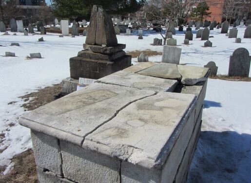
PUBLIC HEARING - Eastern Cemetery Marker Replacement

Eastern Cemetery marker.JPG

Greater Portland Landmarks supports the retention of historic materials to the greatest extent feasible. We encourage all the stakeholders to consult a stone conservator prior to making a decision on this application to replace the historic table stone and to consider alternative ways to provide supplemental information about the significance of the interred individual to visitors and researchers.
For More Information>>

WORKSHOP - 200 Federal Street

Greater Portland Landmarks concurs with the staff comments, that given the eclectic character of the development’s context and the lack of strong architectural cues to inform the design, there is a greater opportunity for design freedom at this location than might be the case in a more homogeneous context like Exchange Street or Commercial Street. Buildings in the Congress Street Historic District are significant for their eclecticism of scale, construction era, architectural style, and materials. The openness of proposed three-story base stands in stark contrast to the foreboding character of the bases at One City Center, Two Monument Square, and even 400 Congress Street. The base will have the most immediate visual impact on pedestrians. We encourage the board to carefully consider the details of this portion of the building and the small pocket park as the design progress in order to enliven the pedestrian experience in this area.

Tonight we express our support for the overall massing, and the visual moves the design team has used to break down the mass when seem from a distance. We thank the applicant for the variety of views they have used to illustrate the visual impact of the proposed building on various historic landmarks, parks, and historic areas.
For More Information>>

WORKSHOP - 275 State Street

The applicant wants to remove the exterior fire escape that was added in the late 20th century.

The applicant wants to remove the exterior fire escape that was added in the late 20th century.

Landmarks concurs with the staff report findings that the removal of the added fire escape provides an opportunity to return key elements of this Colonial Revival residential structure to its documented appearance. The 1924 tax photo of the building should set the direction for any replacement work and help to guide decisions where design modifications are necessary.

For More Information>>

Advocacy in December

It is a busy meeting week in Portland! There will be a City Council workshop on Wednesday to set goals for the Council in 2021. There will also be Planning Board, Historic Preservation Board, and Public Art meetings this wek. Read on to learn more about the projects that are expected to be discussed this week:

Portland Planning Board meeting - Tuesday, December 15th @6PM

A rendering of the redeveloped hospital building from Spring Street.

A rendering of the redeveloped hospital building from Spring Street.

The redevelopment of 148 State Street, the current Mercy Hospital building, will be on the agenda at Tuesday’s meeting. The planning board will hold a public hearing on a proposal to rezone the hospital parcels from R6 to B3, a zone change that would accommodate denser housing on the site and some small scale commercial uses in the lower floors of the existing hospital building that would be challenging to reuse as residential. The rezoning request by the applicant was expanded at the request of city staff to include the mostly non-residential buildings on the opposite side of State Street, including St. Luke’s Church, the State Street Church, and Landmarks’ former offices at 165 State Street. Below is Landmarks’ statement for the public hearing on Tuesday.

Mercy Hospital's history began in 1918 during the Spanish Flu pandemic. Tonight, over 100 years later in the midst of yet another pandemic, we are discussing the redevelopment of the iconic hospital building on State Street built by the Sisters of Mercy during World War II from 1941-1943. Greater Portland Landmarks is pleased to support the redevelopment of the Mercy Hospital parcels and the proposed rezoning, which we believe will bring new life to the two historic buildings and provide much needed new housing and care facility beds in Portland. The proposed redevelopment project is an excellent example of how historic districts and buildings can accommodate new housing, particularly affordable housing. The proposed rezoning will also provide greater flexibility for the reuse of other non-residential historic buildings on State Street if they too should need to be redeveloped sometime in the future. 

The rezoning of the Mercy Hospital parcels is only the first step in the process of the site's redevelopment. We are hopeful, given the renderings thus far, that the proposed new construction and site features will be designed to knit together the fabric of the neighborhood along Winter, Gray, and State Streets.  Street trees, building details, and pedestrian transitions between the sidewalk and buildings entrances will be important design elements to consider as the site is developed so that the new buildings will fit within the context of the historic neighborhood. We look forward to the project progressing through the Historic Preservation Board and Site Plan Reviews and to its successful redevelopment as Mercy Hospital consolidates its functions to its Fore River campus. - Greater Portland Landmarks 12/15/2020

Join the zoom meeting or contact the Planning Board at planning@portlandmaine.gov


Portland Historic Preservation Board Meeting - Wednesday, December 16th at 5PM

There are three items on the Board’s agenda this week. The Westin Hotel on High Street, the hotel under construction at 1 Center Street and the building at 110 Exchange Street are all proposing rooftop additions.

Join the zoom meeting

A proposed new residential unit atop the building at 110 Exchange Street.

A proposed new residential unit atop the building at 110 Exchange Street.

A proposed deck on the rooftop of the Westin Hotel.

A proposed deck on the rooftop of the Westin Hotel.


Portland Public Art Meeting - Wednesday, December 16th at 4PM

The Public Art Committee is expected to discuss the final renderings of the Congress Square Plaza public art piece and the status of the process of the Bramhall Square redesign. While no images were included with the agenda, if any are posted during the meeting, we will update the blog and share them with you!

Join the zoom meeting


City Council Workshop - Wednesday, December 16th at 5PM

Meeting agenda

Join the zoom meeting

Historic Preservation Meeting 11/4/2020

The Historic Preservation Board will hold a workshop on Wednesday, November 4th, starting at 5PM. All city meetings are being held virtually via Zoom:

The following projects will be discussed at the Board’s workshop tonight:

29-35 Commercial Street, the Galt Warehouse Block

The proposed alterations will accommodate a change in use of the mid-19th century warehouse building’s upper stories from offices to residential units. Applicant’s image of the proposed rooftop addition.

The proposed alterations will accommodate a change in use of the mid-19th century warehouse building’s upper stories from offices to residential units. Applicant’s image of the proposed rooftop addition.

Staff Memo

Drawings

110 Exchange Street, John M. Adams Block

The proposal is for a two-story rooftop addition to accommodate a residential unit on the top of the 1892 commercial block. Applicant’s image of the proposed rooftop addition.

The proposal is for a two-story rooftop addition to accommodate a residential unit on the top of the 1892 commercial block. Applicant’s image of the proposed rooftop addition.

Portland’s Ghost Signs

portlandcoghostsign.jpg

By Anastasia Azenaro-Moore

Painted wall signs are nearly as old as writing itself. Ancient Egyptians used to carve public notices on steles, Phoenician merchants painted rocks to advertise local market stalls along well-traveled trade routes and painted wall advertisements were found in the ruins of Pompeii. Outdoor, painted wall advertising continued to grow and evolve, even as literacy declined, during the Middle Ages. The first inkling of the modern American wall advertisements came from the European Renaissance when painted signs were fixed to the fascia of buildings. The apex of outdoor advertising was the creation and proliferation of painted wall signs throughout American cities from the late 19th century into the mid-20th century.  

Wall-painting in America rose to prominence in the late 19th century, not so coincidentally at the same time new building technology allowed for taller structures. The signs painted on these structures, often three or four stories up from the ground, were intended to be visible for faster modes of transportation. During the late 19th century, elevated trains first made their appearance in America’s cities as did electric trolleys. Later, in the 20th century, automobiles would stake their claim in America’s cities, and in order for these signs to be seen from increased speed they had to be larger. 

e-swasey-co-portland-5-hdri.jpg

Portland has dozens of these painted wall signs, known as “ghost signs”, mostly concentrated in the Old Port and along Congress Street. These signs span over 100 years and advertise everything from hotels to  locomotive manufacturing. These signs are in varying states of decay with some, like the “E. Swasey & Co” sign at 267 Commercial Street in remarkable good condition for its age, while others like the “Everett Chambers Hotel” at 51 Oak Street are in rougher shape despite being newer. This is largely due to the paint used, with older white lead-based paints holding up better against the elements than colored paints. 

Other signs, such as the “Casco” Beverages sign at the former Corbetts Market Groceries on 21 Pleasant Street, are examples of a privilege sign. Privilege signs were wall advertisements for national or local companies, such as Coca-Cola. In exchange for the use of wall space, the local business or merchant would be promoted on the sign free of cost. Often these companies chose to place these privilege signs on retailers that sold their products - hence the prevalence of privilege signs for local markets and grocery stores - but, on rare occasions, national companies would use the walls of non-related retailers.  

Portland’s ghost signs face many of the same threats that ghost signs face nationwide: rampant development and general wear and-tear due to exposure to wind, sun, rain and snow. We can even see, if we try hard enough, where some of these former ghost signs once stood. Take the Dry Dock, for example, where one can still see the shape of a former sign for Randall and McAllister’s Coal Company.  

These ghost signs are an important part of Portland’s legacy and they reveal stories of immigration, a changing economy, and a growing city. These remnants can be seen on apartment buildings, restaurants and department stores; creating a map of Portland’s past. This map lays out our city’s history and the key is to just look up.

eastmanbros1.jpg
esatmanbros2.jpg

11 Brown Street: Eastman Brothers & Bancroft

Eastman Bros & Bancroft was established in 1865 by Bricino M. Eastman, Fred E. Eastman, and Ermon D. Eastman. The department store specialized in dry and fancy goods including wallpaper, glassware, lady’s cloaks, silks, linens and suits. The store closed in 1932, a victim of the Great Depression, and in 1937 Filenes opened in this location.

16 Forest Ave: Congress Square Billiards Hall

forestavebilliards.jpg

Congress Square Billiards (8a Forest Ave) was established in 1933 and lasted until 1954. Its name derived from the pool hall’s proximity to Congress Square, a small space, now a park, to the immediate north of the Eastland Hotel (completed in the late 1920s). In 1940, Congress Square Billiards had 8 pool tables and 2 billiards tables. While there is scant information available on the history of Congress Square Billiards itself, the existence of the billiards hall speaks to a larger narrative of the night-life of Portland in the mid 20th century. In 1940, there were six locations that were advertised where one could play pool or billiards (including the Boys Club of America and the Y.M.C.A) within a small section of town between State Street and Forest Ave. Portland’s downtown also boasted 9 bowling alleys within a two-mile radius. Today, there are three pool halls in the entire city and two bowling alleys.

Portland's Changing Waterfront

An image of the Portland waterfront c1900. Image from the Maine Historical Society’s Maine Memory MMN#13916

An image of the Portland waterfront c1900. Image from the Maine Historical Society’s Maine Memory MMN#13916

is our historic waterfront at Risk?

Portland’s central waterfront extends along the south side of Commercial Street, from Deake’s Wharf in the west to Maine Wharf in the east. This central zone has been a significant economic and cultural asset for over 350 years. It is the largest resource for commercial vessel berthing in Portland Harbor, sitting between the western waterfront (featuring deep sea berthing and dedicated to freight and industrial uses) and the eastern waterfront (a transportation hub with facilities for cruise ships and ferries). The central waterfront is the heart of our tourism industry as well as the core of the city’s working waterfront.

Figure 1. Portland’s waterfront in 1776. Courtesy of Rosemary Mosher and Osher Map Library.

Figure 1. Portland’s waterfront in 1776. Courtesy of Rosemary Mosher and Osher Map Library.

Figure 2. NOAA’s projected inundation map of Portland with a ten-foot surge.

Figure 2. NOAA’s projected inundation map of Portland with a ten-foot surge.

The central waterfront we know today is filled land, built to facilitate a railroad connection between the east and west ends of the city. This makes the area particularly vulnerable to increased storm surges, high tide events, and projected sea level rise. Modern flood and storm surge projections show the extent of possible flood waters mirrors the known historical shape of the peninsula. A composite map showing the peninsula’s coastline in 1776 versus today (Figure 1) is closely replicated by NOAA’s Sea Level Rise Viewer when predicting a ten-foot surge in sea level (Figure 2). NOAA classifies the entire central waterfront as “highly vulnerable”.

Figure 3. Tidal flooding on Portland Pier has been occurring for many years.

Figure 3. Tidal flooding on Portland Pier has been occurring for many years.

A 2013 Flooding Vulnerability Assessment for the Commercial Street waterfront area predicted the cumulative expected storm damage to the value of all buildings and improvements between 2013 and 2050 to reach $32.9 million. According to that assessment, in 2050, buildings on every wharf from the Portland Fish Pier to the Maine State Pier are vulnerable to significant damage. Buildings on Widgery Wharf and Portland Pier, two of the Central Waterfront’s most historic wharves, are at risk of being permanently inundated due to sea level rise by 2050. Portland Pier (which has some of the Central Waterfront’s most historic structures), has historically been particularly prone to flooding (Figure 3).

Early History of Central Waterfront - Infilling and the Creation of COMMERCIAL Street

Figure 4. From a 1826 manuscript map titled Portland with a view of the different streets by Lemuel Moody (1767-1846) features the city streets and designations, as well as buildings, wharves and rope walks. Portland wharves extend from Fore Street,…

Figure 4. From a 1826 manuscript map titled Portland with a view of the different streets by Lemuel Moody (1767-1846) features the city streets and designations, as well as buildings, wharves and rope walks. Portland wharves extend from Fore Street, then the shore line along the central waterfront.

By the end of the eighteenth century, Portland was a booming center of trade, supported by its lumber trade and fisheries as well as the rise of the molasses trade. Trade with the West Indies became quite lucrative for Portland, who exported a wide array of wood products in exchange for the sweetening agent. Molasses was a common dietary staple and used in rum production.

The area around today’s central waterfront was a bustling commercial and cultural center. Merchants and tradesmen relied on the sea to ship and trade cotton, flour, salt, fish, tobacco, wine, rye, glass, and lumber in several forms. Store owners, shipbuilders, blockmakers, silversmiths, blacksmiths, and distillers operated on the waterfront. At the time, the wharves that had sprung up following the Revolution were breastworks, or rudimentary docks made of piled lumber, rubble, and stones. A more substantial, permanent wharf was required to accommodate traffic coming in and out of the harbor.

In 1793, a group of 25 sea captains and merchants formed a group, calling themselves the “Proprietors of Union Wharf.” They set out to build an appropriate structure on a breastworks that sat at the foot of Union Street. The resulting wharf had no comparison in the harbor. The 110-foot wide structure sat upon a base of rocks, dirt, and other fill material, which supported massive oak pilings covered with wooden planks. Over 3,500 tons of lumber was used to construct the wharf, which boasted a 48-foot-wide passageway through its center. The wharf was promptly populated with ten or so businesses. Other wharves quickly took form and by 1806 Portland had emerged as the sixth largest seaport in the country.

Figure 5. Portland Public Works overlay maps circa 2001 depict the evolution of the Portland waterfront. The blue lines depict the original shoreline close to Fore Street.

Figure 5. Portland Public Works overlay maps circa 2001 depict the evolution of the Portland waterfront. The blue lines depict the original shoreline close to Fore Street.

The mid-eighteenth century and the rise of railroads brought about the most dramatic physical transformation of the waterfront’s history. Access to Canadian ports was limited during the winter months due to the St. Lawrence River freezing over. In an attempt to lure Canadian trade to Portland, Board of Trade leader John A. Poor spearheaded the effort to extend Canada’s Grand Trunk Railway from Montreal to Portland. Poor espoused Portland Harbor’s natural advantages and the half-day of travel time that could be saved by choosing it over Boston or New York. The Atlantic & St. Lawrence Railroad, later taken over by the Grand Trunk, brought car loads of grain to Portland from Canada and the West for reshipment.

In order to link the Canadian Grand Trunk Railway to the Portland, Saco & Portsmouth Railroad terminal at the foot of High Street and Portland’s wharves, city’s leaders agreed to build a new road with tracks down its center running perpendicular to the waterfront’s docks. Completed in 1853 for $80,000, Commercial Street was 100 feet wide and nearly a mile long, and was constructed on filled land in the harbor east of Fore Street (which originally followed the shoreline). The road was constructed through the middle of existing wharves, and obscured smaller wharves completely (Figure 6). As a result, businesses that were once dockside now had a new street between them and the water, and other lots were lost completely. Wharves lost hundreds of feet of berthing space and building space.

Figure 6. An 1852 map of Portland shows the construction of Commercial Street on the Waterfront before the land between Fore and Commercial Streets was completely filled in.

Figure 6. An 1852 map of Portland shows the construction of Commercial Street on the Waterfront before the land between Fore and Commercial Streets was completely filled in.

Figure 7. On an 1858 Map of Portland, just five years after the completion of Commercial Street, five wharves (Union, Dana’s (Merrill’s), Brown’s, Smith’s, and Berlin Mills) had built connecting tracks to take advantage of increased trade opportunit…

Figure 7. On an 1858 Map of Portland, just five years after the completion of Commercial Street, five wharves (Union, Dana’s (Merrill’s), Brown’s, Smith’s, and Berlin Mills) had built connecting tracks to take advantage of increased trade opportunities.

On new or extended wharves, businesses quickly took advantage of the presence of the new railroad along the waterfront. Within five years of Commercial Street’s completion, connecting tracks were built down the lengths of several wharves (Figure 7). Canada’s grain was exported from the port, while lumber, shipbuilding, molasses, and fish remained important industries.

The wharves on the central waterfront were all constructed as working piers (as opposed to pleasure piers), specifically intended for the docking, loading, and unloading of vessels. The area’s wharves are largely fill supported, often with wood pylons supporting the apron (outer edge) and terminating end, farthest from Commercial Street. Wharf builders obviously made use of Maine’s abundant supply of granite and pine during their construction. Structures on the wharves vary drastically in scale from 100,000 square-foot masonry factories to 8-by-10-foot wood-frame fish houses. From early images we know that many wharves were paved with granite paving blocks.

The 20th Century - A crumbling waterfront

Portland’s waterfront at the turn of the century was populated by ferry terminals, steamship docks, lumber yards, coal companies, cooperages, and cold storage facilities.

Figure 8. Portland Cold Storage Co. circa 1905.

Figure 8. Portland Cold Storage Co. circa 1905.

Portland Cold Storage Co. was located at 188 Commercial Street on Central (now Chandler's) Wharf. Founded in 1905, the cold-storage firm was managed by James C. Poole (1845-1924) of Boothbay Harbor (Figure 8, pictured standing at left). In 1915, Poole formed another cold storage company on Union Wharf. Train tracks allowed rail cars to be loaded and unloaded right outside the storage building.

Figure 9. A 1900 advertisement for Berlin Mills Co lumber yard and planing mills. Upper right is now Gowen Marine/Portland Yacht Services (Becky's Diner would be to the left of the image). Image to lower right is at the north corner of High and Comm…

Figure 9. A 1900 advertisement for Berlin Mills Co lumber yard and planing mills. Upper right is now Gowen Marine/Portland Yacht Services (Becky's Diner would be to the left of the image). Image to lower right is at the north corner of High and Commercial Streets, now the Rufus Deering Lumber/Hobson’s Landing development.

On the western end of the central waterfront was a large lumber yard, the Berlin Mills Company. In 1851 the St. Lawrence & Atlantic Railroad, later changing its name to Grand Trunk Railway, entered Berlin, New Hampshire. The chance to build a saw mill in Berlin came in 1852 when a group of Portland, Maine businessmen, John B. Brown, Josiah S. Little, Nathan Winslow and Hezekiah Winslow, recognized that the construction of the railroad line through Berlin was a great way to import and export wood products in and out of town. Acquiring water, timber and rail rights, they formed a partnership under the name H. Winslow & Company, which changed its name to Berlin Mills Company in 1868. In Portland the company had a planing mill and wharf for shipping lumber.

In 1889 the Canadian Pacific Railway opened a rail line across the state of Maine from Montreal to Saint John, New Brunswick, transferring the majority of Canada’s transatlantic passenger and cargo shipping to the Saint John during the winter months. This resulted in a loss of Canadian trade revenue in Portland, and Portland lost its standing as a leading regional seaport. The Great Depression in the 1930s caused additional hardship on Portland’s waterfront.

World War II briefly gave the city and its waterfront an economic boost. Portland Harbor became the base of the entire North Atlantic fleet, complete with 30,000 shipyard workers and anchorages filled with Naval destroyers and support vessels. Waterfront merchants profited from the presence of shipyard workers and sailors on leave. However the economic boom of the war years quickly dissipated when military activities ended.

A 1961 Portland Press Herald series, “Our Crumbling Waterfront,” painted a stark picture of the port, describing rotting pylons, empty buildings, and an economic slump. A focus on downtown redevelopment in the Urban Renewal period of the ‘60s and ‘70s, left no little to no funds to devote to the waterfront. A 1978 National Science Foundation study described Portland’s waterfront as one of the most decrepit on the east coast. The following year, voters and public officials were sympathetic to the waterfront’s plight and approved a $9 million bond to help pay for fish piers in Portland.

Spurred by the completion of the Portland Fish Pier in 1983, new construction projects replaced deteriorating piers and rotting pilings across the waterfront. Condominium construction on Chandler’s Wharf in 1985 and at 40 Portland Pier in 1987 as well as other development proposals led to a 1987 moratorium on all development along the waterfront that was non-marine related. The moratorium was overwhelming approved by Portland voters who wanted to protect the working waterfront from non-marine uses. Since the mid 1980s, the city has been challenged to balance protecting fishing and other maritime industries while also promoting a flexible and varied waterfront for non-marine businesses and development.

Will the waterfront’s future look like its past?

Corey Waterfont.jpg

A 2018 inventory of the waterfront observed that the central waterfront remains a center for marine industry, but continues to evolve as permitted under current land use policies. According to the City’s Comprehensive Plan Portland 2030, there has been significant contraction of the waterfront economy and the ground fishing industry on the central waterfront since the 1990s. Ground fishing vessels have diminished by 50% and there has been a 2/3 reduction in landings at the Portland Fish Exchange. The area has also experienced decreasing water depth at the piers due to natural deposition of sediments, which are exacerbated by storm water overflows into the harbor, requiring maintenance dredging to ensure quality commercial berthing opportunities.

Additional planning initiatives for the central waterfront in the City’s comprehensive plan include: investing in pier infrastructure, and exploring funding for pier maintenance; promoting access to the waterfront for commercial and marine activity, including berthing; supporting traditional and emerging marine industries, requiring collaboration with private pier and waterfront property owners to implement policies that promote and protect the marine economy; and planning for climate change.

If the prediction maps are correct, sea level rise needs to be part of the conversation about the future of development along Commercial Street and on the waterfront. Its historic buildings, infrastructure, and its uses, that are so integral to our city’s character and economy are in danger. Public and private leadership, like that which led to the creation of Commercial Street, is necessary to develop comprehensive planning strategies that will guide owners as they assess the risk to their waterfront assets and to direct investments into more resilient infrastructure. Part of the solution will also need the City’s technical standards and land use code to allow for adaptive construction techniques, storm water infrastructure and utilities, site protection, and floodproofing.

At Landmarks we are focused on collaboration and broad public engagement initiatives with other organizations working to raise awareness of the issue as well as developing proactive and sustainable solutions. You can learn more about our work on our website or take a short virtual tour of the waterfront. Stay tuned for upcoming events this summer that will celebrate the history of our waterfront and how historic preservation and the conservation of existing resources are key to developing a strategy of resiliency, risk management and adaptation which will guide changes on the waterfront in the future.

This fall, Greater Portland Landmarks will host a series of panel discussions about the unprecedented challenges to Maine’s cultural and natural heritage due to our changing climate. Bringing together organizations and community leaders, Staying Above Water will highlight the impact climate change is already having on historic buildings and discuss strategies for future adaptation. Landmarks will publish a booklet of case studies later this summer that explore the impacts of a changing climate on a variety of local building types and suggest mitigation strategies for property owners. We hope you will join us!


by Julie Ann Larry, from research compiled by Tova Mellen in 2019.

Architect of the Week: George Burnham

By Alessa Wylie

Perez Burham House

Perez Burnham House

Somerset Apartments

Somerset Apartments

One of Maine’s most accomplished architects of the early 20th century was George Burnham (1875 – 1931) of Portland. Born in Portland, he received his professional training from Massachusetts Institute of Technology. He briefly worked in Boston before moving to New York City to become a partner in the firm of Tryon, Brown & Burnham. He designed a number of houses on Long Island before developing typhoid and pneumonia and moving back to Portland in 1902. Back in Portland, he designed a house for his father Perez Burnham on the Western Prom, and the Somerset Apartments on Congress Street for Henry Rines.

03 Freeport Library.jpg

In 1904 Burnham beat out eight other architects from Portland and Massachusetts, including John Calvin Stevens, Frederick Tompson, and Francis Fassett, to win the competition to design the Cumberland County Courthouse. The deciding factor for him to be chosen over these other established architects seems to have been the fact that his design achieved the right balance of architectural grandeur at a reasonable cost. According to newspaper accounts at the time, other designs were favored but would have been more expensive. The courthouse construction kept Burnham busy from 1905 until its completion in 1909. He did, however, work on smaller projects including design of the B.H. Bartol Library in Freeport in 1905. In 1910 he designed the Stanley Pullen Memorial Horse Trough just down from the Courthouse on Federal Street.

Cumberland County Courthouse

Cumberland County Courthouse

Pullen Fountain

Pullen Fountain

In 1909 Burnham took on E. Leander Higgins, a fellow M.I.T. graduate, who became a partner in 1912. Together they designed plans for houses and factories. The houses they designed were large, spacious and comfortably laid out.  In 1912 he built a semi-detached double house at the corner of Carroll and Chadwick Streets, and lived in one of the houses for two years before designing a house and one for his mother next door in Falmouth Foreside.

Carroll Street House

Carroll Street House

In 1913 Burham and Higgins designed two large factories in two quite different settings. The Burnham & Morrill Plant, with its highly visible location, highlighted the more ornamental aspects of the building by contrasting the concrete, brick and glass of the exterior. The building immediately became a local landmark and remains one today.

Burnham & Morrill Factory

Burnham & Morrill Factory

The Portland Shoe Manufacturing Company, on the other hand, was located on Pearl Street in a dense urban setting. The building was tall and narrow following the latest architectural trend of simplicity of design. In both buildings the architects chose to emphasize the building materials used in their structures rather than applied decorations.

Portland Shoe Factory

Portland Shoe Factory

By 1917, Burnham & Higgins was one of the leading architectural firms in Maine designing for individuals and businesses, but when the U.S. entered World War I, George Burnham enrolled in the Army’s Officer’s Candidate School where he thought his engineering skills could be put to good use. While in training in Kentucky he became seriously ill and had to take a medical discharge. By 1919 he retired to his home in Falmouth Foreside. His final work in the 1920s was a remodel of a friend’s house in Yarmouth. In his final years Burnham experienced severe mental depression and took his own life in April, 1931.

George Burnham and his partner, E. Leander Higgins, designed both residential and commercial buildings and created several exceptional examples of early 20th century architecture in the Portland area that remain local landmarks today.

Source: Maine Historic Preservation Commission’s Biographical Dictionary of Architects in Maine.